Baranof’s Southwest Coast

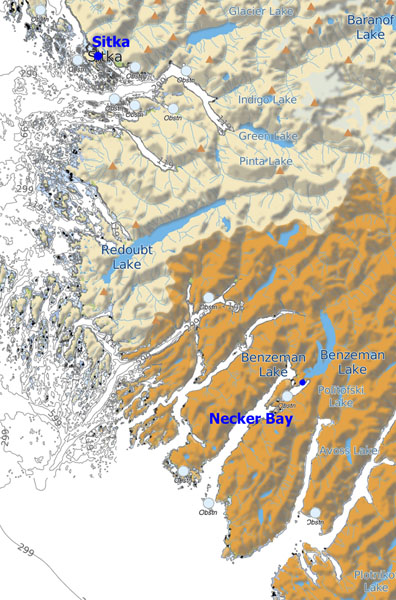
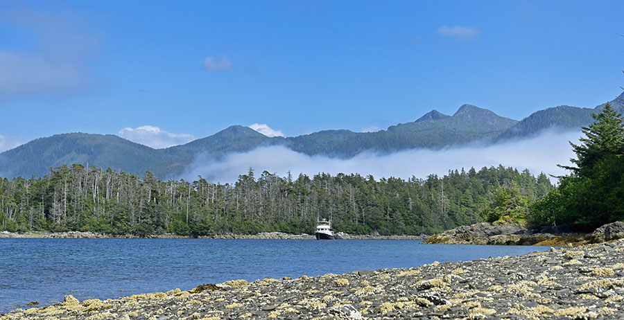
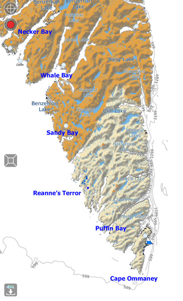
We’ve enjoyed amazing weather these past few weeks, with bright days, light winds and flat ocean conditions for traveling. It can’t last. You can see the southen part of Baranof Island on the map below, with those glorious deep fjords, myriad lakes, mountains and anchorages to visit. Too much to see in one season. The places I labeled in blue are the bays we visited, shortening our stays and skipping a couple of spots as the weather pattern started to change.

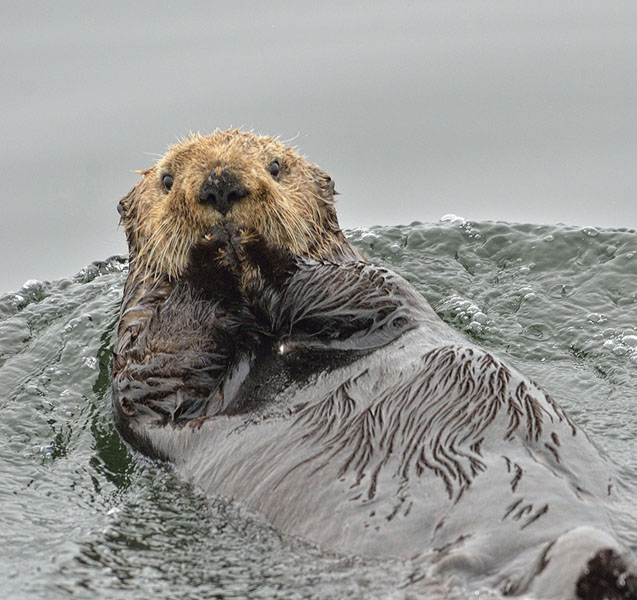
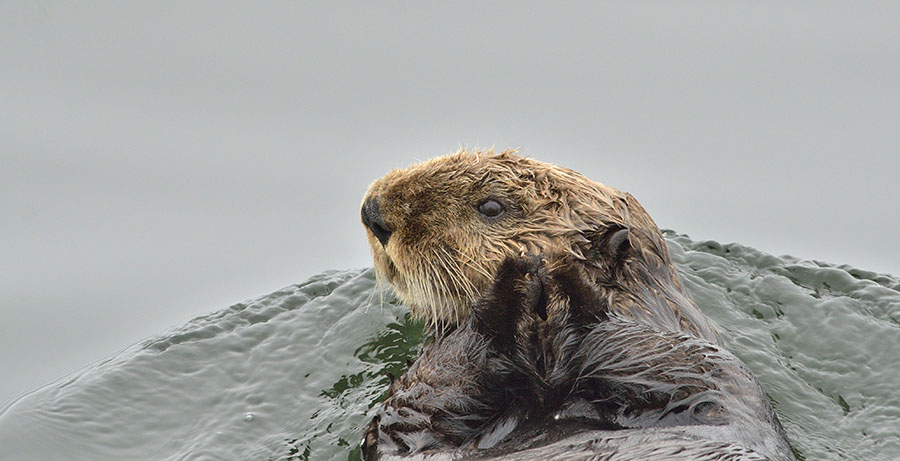
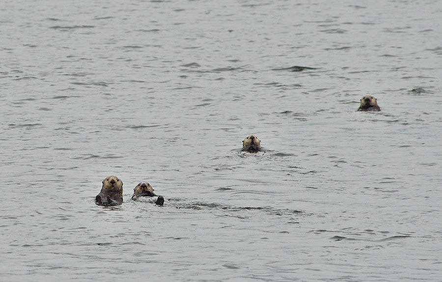
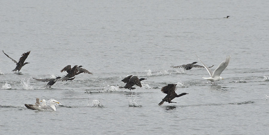
The last time we were on the outside coast here we made it as far as Whale Bay where we had to hunker down in the aptly named Still Harbor waiting for the weather to ease. It never improved much, but was predicted to get much worse in the coming days so we headed back towards Sitka and protected waters. This time we were determined to explore much more of Whale Bay, but a long finger of thick fog came off the ocean and extended up both arms of the fjord all day and into the next. We had clear weather in the anchorage, and enjoyed watching the dozen or so harbor seals dozing on the rocks, but we weren’t going to see anything if we headed farther into the bay. As soon as we got back out in the ocean the next morning the skies cleared to reveal sea otters…

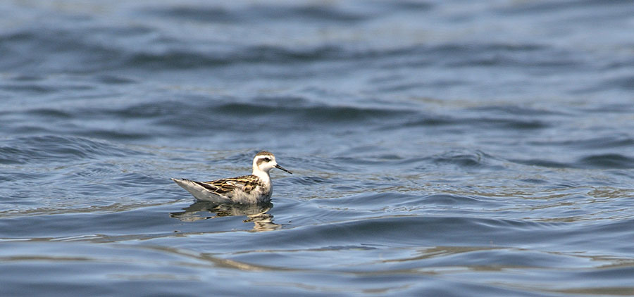
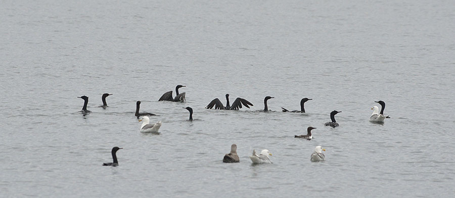
…and birds – horned puffins, sooty shearwaters, red-throated loons, murrelets, common murres, cormorants and (of course) gulls.

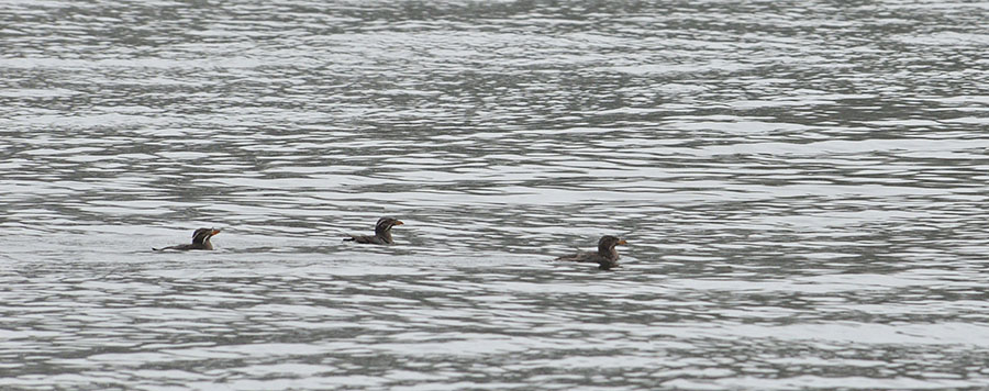
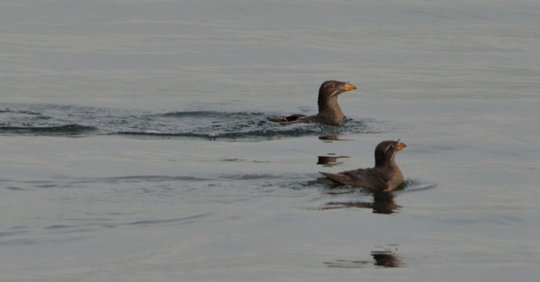
Friends who were commercial trollers in this area recommended Sandy Bay, and wow – what a beautiful place! As we turned the corner into protected waters we saw a tall cascade waterfall and some rhinocerous auklets bobbing around (I didn’t get a good photo – they were pretty shy.)

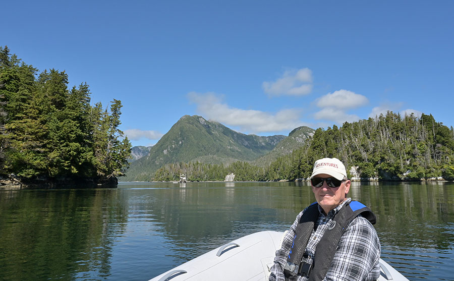
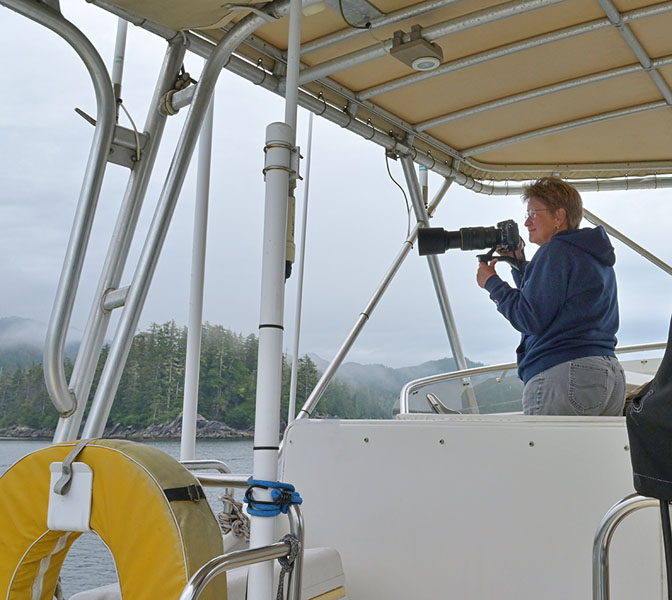
I’ve had a few people complain lately that the only human they ever see on the Blog is Jim. I hate having my picture taken, but I took this one to silence the critics…

me (Robin)

…and Jim got one while I wasn’t looking.

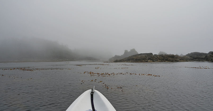
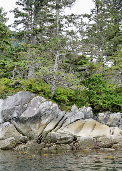
I did my usual exploration by kayak, waiting for high tide so I could get up the creek near our anchored boat. No fish and no bears… but it was certainly beautiful.

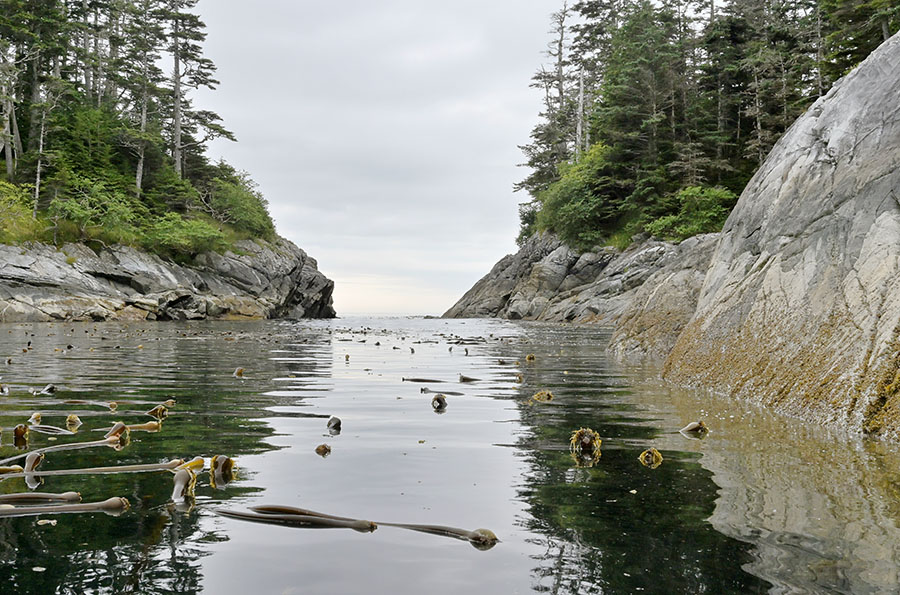
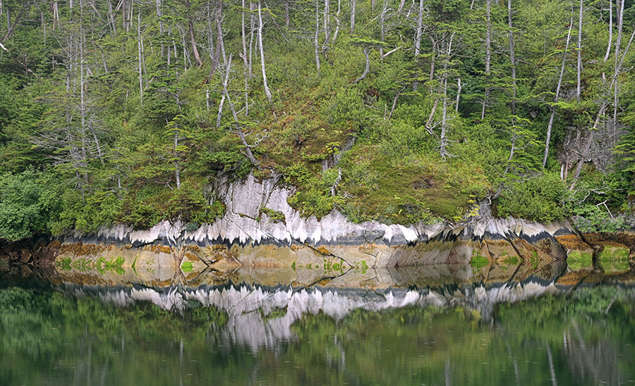
The next day we headed farther south to anchor in No Name Bay, known in the Douglass cruising guidebook as “Reanne’s Terror”. In the video below you can see how nice and flat calm the ocean is on this overcast day, but look closely at the rocky entrance and notice that it’s scoured bare to a considerable height. Now imagine the ocean on a grumpy day and picture the waves crashing there!

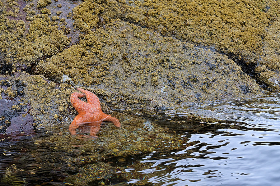
I paddled the entire bay…

…savoring the silver snags on shore and the bright sea stars that really popped against the monochrome of the gloomy day.

I spotted a mink and an orange crowned warbler in my kayak travels – something special!

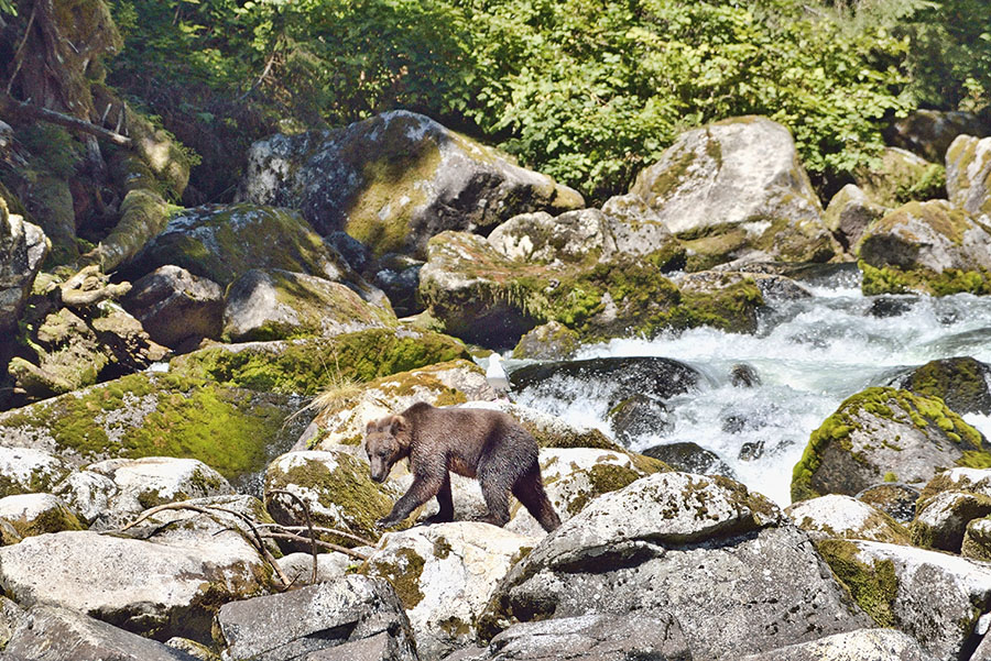
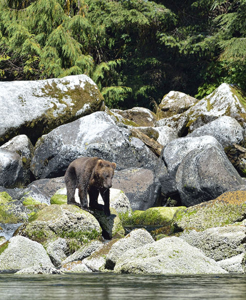
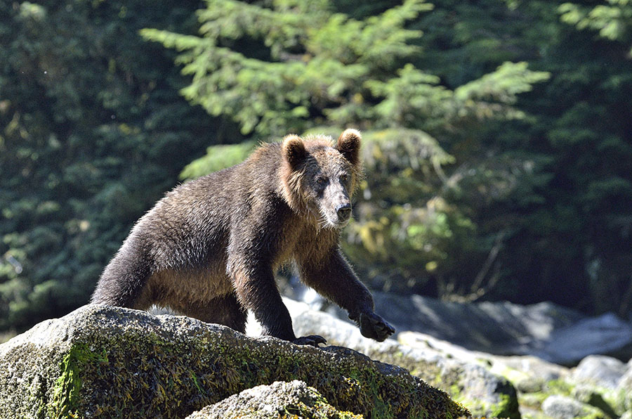
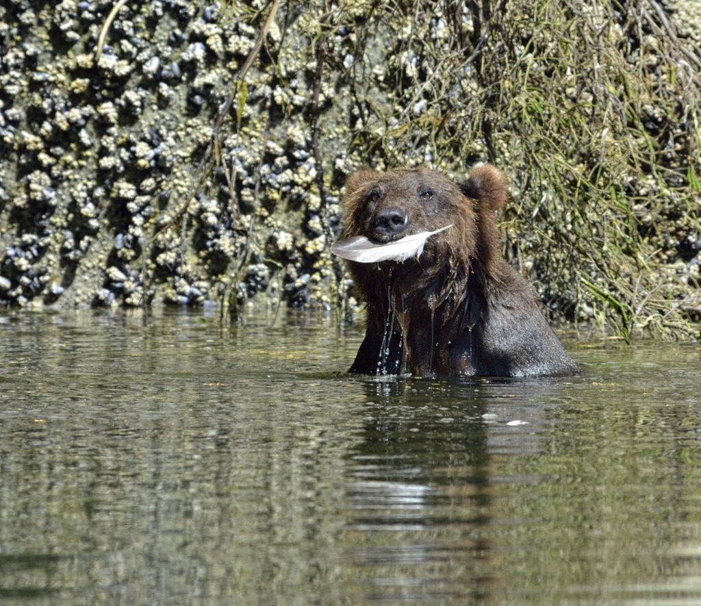
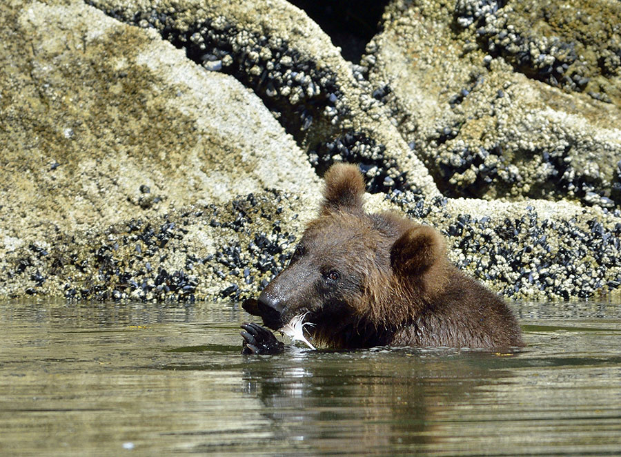
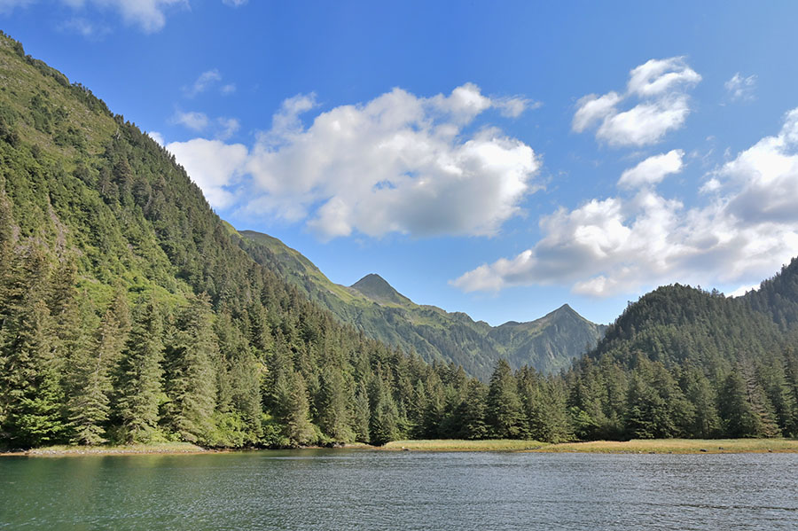
Our weather window was definitely starting to close in a couple of days so we skipped Redfish Bay and headed to Puffin Bay – the closest good anchorage before rounding Cape Ommaney. Right at the head of the bay we turned out of the fog into a gorgeous protected cove with a nice looking salmon stream. But no bears. The streams are no where near their normal levels because of the very dry summer (we’re in a drought), and the increased water temperature is impacting the salmon populations. Bad for the fish, bad for the fishermen, and bad for the bears.

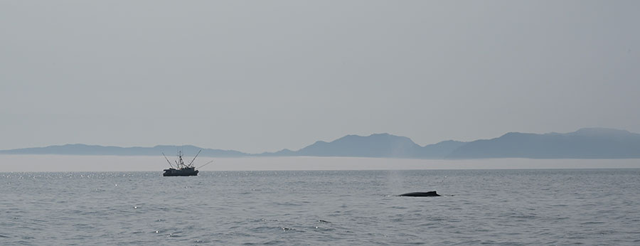
Not surprising, we had a foggy trip down the coast and around Cape Ommaney… this month is “Fog-ust”, after all. As we got across the entrance to Chatham Strait, we spotted a number of trollers and whales, plus more rhinocerous auklets.

We tucked into the cove at Warren Island, and I’ll tell you about Warren and Sea Otter Sound next time.

A Bear Tale

Finally… we found a bear – the first one we’ve seen since Glacier Bay over a month ago! But let’s not get ahead of ourselves. First, let me show you where we are relative to Sitka, on the outer (west) coast of Baranof Island. You can see the mass of rocks, reefs and islands along the upper coast – offering some protection from ocean waves for traveling and an endless array of nooks and crannies to explore and anchor in. But now we’ve moved farther south and are cruising in the deep fjords that are more open to the ocean. Just stunning. We ran into some folks in Sitka who recommended that we check out the head of Necker Bay, and “Local Knowledge” is often worth its weight in gold.

The smaller bay at the head of Necker Bay is called Secluded Bay, and it was a spectacular spot. There’s a waterfall and mountain lake (hidden by the forest). Salmon were jumping all over the place. We anchored ADVENTURES around the corner from the waterfall, next to a tiny island, which turned out to be a great decision because the sunny weather meant that an onshore wind picked up in the afternoons, and we were protected from it.

I splashed the kayak and paddled around to investigate the waterfall and to see if I could spot the trail up to Benzeman Lake. This should be prime bear territory, with masses of salmon gathered at the mouth of the falls. (Salmon season is not the best time for hiking right next to a stream, but I wanted to make a note of it in case we’re back at a different time of the year.)

I also wanted to find a good spot to fly the drone from, since the boat was too far and I would have too much interference from the dense forest. The rocky fan at the mouth of the falls was the only decent spot, but by the time I was paddling back to the boat the afternoon wind suddenly started blowing and it continued for the rest of the day. The next morning we took advantage of the calm – Jim and I headed back to the waterfall with the dinghy and the drone… and we spotted a bear!

It appeared to be a young bear – probably a 3 year old, kicked out on its own by its mother this past spring, and it was wandering around the mouth of the falls occasionally catching a fish.

We watched it for a while, but we were anxious to make the drone flight since we knew the afternoon wind would come up fast and strong in that long, skinny inlet – our good flight conditions were not going to last.

We sat in the skiff in shallow water off to the side of the falls watching the bear catch fish, and I photographed him with the long lens. It didn’t seem concerned about us, since at one point it got curious and started moving towards us.  We both said “HEY BEAR!” and that didn’t seem to deter it – I started the outboard and was ready to back up fast, but it veered off and walked along the shoreline, playing with a feather (very cute) and cooling off in the water a bit. 

Eventually the bear hid in some shade under a tree a decent distance away from us, and I could see it watching us.

Jim tossed the drone landing pad on the rocky shore, set the drone down on it, and had me stay in the dinghy to fly.  He stood in the water next to the dinghy, ready to hop back in if the bear returned.  I’m normally a little nervous when I fly, and this day I was DOUBLY nervous!!!  Jim couldn’t see the bear, but I could – so I had to pay attention to flying as well as the bear and Jim.  I kept the flight short and sweet, but the sweeping view of that mountain lake was well worth the effort to get some video footage!  Stunning. 

I was working the drone down and towards us when the bear came back out of the woods onto the rocky fan.  I happened to have the drone camera pointed down and caught a little bit of him on video.  Jim kept the drone landing pad back in the boat – we didn’t want the bear to take an interest in it.  Once out of the woods the bear veered back towards the stream to fish, away from us.  As soon as it was far enough away Jim tossed the landing pad back on shore (not in a perfect spot, but I wasn’t about to ask him to adjust it!) and I brought the drone down for a landing as fast as I could.  Jim grabbed the drone and landing pad, and we got the dinghy away from there.  That was an adrenaline rush, for sure. 

Just as we backed the dinghy out of there the wind came up, and we had whitecaps by the time we were halfway back to our sheltered anchoring spot. Lucky timing!

It’s always hard to leave a beautiful place, but if we don’t leave we’ll miss all the other ones. We decided to anchor at the mouth of Necker Bay for a night, tucked behind Yamani Island. It’s a terrific place to explore by kayak, with little rocky passes open to the ocean. We had clear skies over the boat…

…but the fog was blowing in from the ocean, and here’s what it looked like right around the corner.

Such a contrast! The fog would come and go, sometimes giving me a nice view of the local wildlife.

Necker Bay was definitely worth the visit! Next stop, Whale Bay, Sandy Bay and Reanne’s Terror.

Narrows

From Goddard Hot Springs we can stay in protected waters behind islands and reefs if we pass through several narrow passes: Dorothy Narrows, First Narrows, and Second Narrows (someone needs to get more creative with the names). Dorothy is the most “exciting” since it’s longer and boats need to announce their plans to transit the narrows ahead of time to avoid having to pass another boat in the tight squeeze. The waterway isn’t all that skinny from shoreline to shoreline, but the navigable part is. The rest is all (unforgiving) rock. After Dorothy we headed down the aptly named Windy Passage then through the short and easy First Narrows.

Right past that narrows is a sweet anchorage – “First Narrows Cove” or “Baidarka Cove”, depending on the guide you use. It’s a fun place to explore by kayak, and there’s a back way out to the ocean. Here’s a little drone video to show you what it looks like at low tide. The entrance channel seems a lot more confined when you’re navigating it in the boat, but it looks much less scary from the air. Enjoy!

I had a ball paddling all around the cove, squirting out the shallow side entrance…

These rocks are hidden when the tide is high!

…and riding the tide back through First Narrows and into the cove from the main channel. Sea stars, kelp crabs, snails, small Dungeness crabs, shrimp, tube worms with their feathery fuschia plumes, anemones, limpets, and tiny abalone are my rewards for low tide exploration. High tide means access to more areas, but low tide – especially those big spring tides – show us more of what’s hiding under the water. I came around an islet and startled a deer walking on the rocky shoreline.

Sometimes people ask us “what do you do all day when you cruise?” It might seem like all we do is lay around perfecting our favorite Margarita recipe as we meander from one pretty place to another, but that’s not very realistic. (We do have a good blender aboard though… just in case.) We like to say that “cruising means fixing your boat in exotic places.” We often stay in one place for two nights, so we have a travel day and a “play” day – time to fix little things, occasionally work on fixing big things, doing projects, planning for the next stops – weather and routing, and then exploring by kayak or dinghy. The nice long stretch of dry days got me started stripping and re-coating some failed paint on the caprails.

Just one of the caprails that needed attention…

Caulking, sanding, epoxy, more sanding, more epoxy, more sanding, primer, sanding, topcoat, sanding, topcoat again… lots of fun. But it needs to be done and we’d much rather work on projects out in pretty places than tied to a dock.

The days are getting shorter now – the sun is setting closer to 8pm and we’re losing light by 4-5 minutes each day. The silver lining is that earlier darkness and warm nights means great conditions for sunsets and stargazing on clear nights.

Our next anchorage wasn’t too far away – about an hour’s easy cruise through Second Narrows into Scow Bay. I rigged up “Adventures-Cam” – a GoPro mounted on the flying bridge – shooting a time lapse of our run from First Narrows Cove to there.

It’s amazing to have a spot right off the ocean that’s totally protected and hidden away. We only stayed there for one night, but had a beautiful moon-set to cap off the evening.

Our next stop will be Secluded Bay at the head of the Necker Bay fjord… stay tuned.

Goddard Hot Springs

After completing our outboard motor repair, we topped off the fuel tanks and headed out of Sitka.

Wandering around the many little islands and reefs, we occasionally got a nice view of Mount Edgecumbe – a dormant volcano, and a striking landmark.

It felt good to be back in quiet anchorages, though we had to dodge around some gillnetters here and there. After doing so many boat projects we decided to stop at Goddard Hot Springs for a nice relaxing soak.

There are two shelters with tubs for soaking, plumbed with both (scalding) hot and cold water from the nearby springs.

Apparently it’s a “thing” to carve or write your boat name on the walls, though we skipped that part. Some of the artwork is pretty impressive! I also found some nice ripe huckleberries nearby, and picked enough for breakfast and snacks.

Because the area in front of the shelters is very rocky and somewhat exposed, we anchored in the bay next door and used the kayaks to get ashore. Even so, the entrance to the adjacent bay has a crazy entrance channel. There’s a huge rock just off-center, but the better channel is through the narrower part, staying close to the rock, and then turning 90 degrees to the left immediately as you pass the rock. The morning after we arrived we had a -3′ tide, which really showed the rock reef and shoals. It’s worth the little bit of excitement to visit the springs, we think. And the area is great for exploring by kayak, with so many little islands.

Bird watching was also good – we saw some juvenile red-necked phalaropes…

…and some red throated loons. They’re hard to photograph against the color of the water, but they’re so graceful and beautiful.

It’s a very scenic area, with the soaking tubs as a bonus, and we sure enjoyed our visit.