Death Valley – Last One

We explored more than just Death Valley on this trip, but we spent the most time there after having such a great time back in 2017. Here are the last of the photos and stories from this year’s adventure.

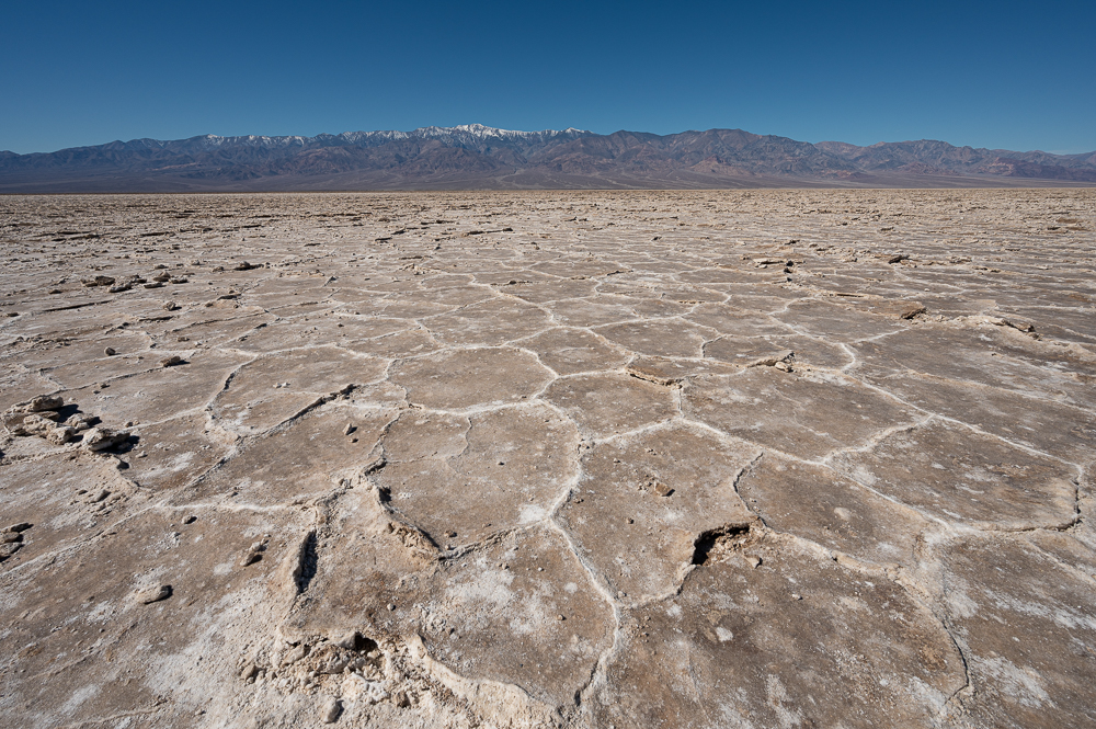
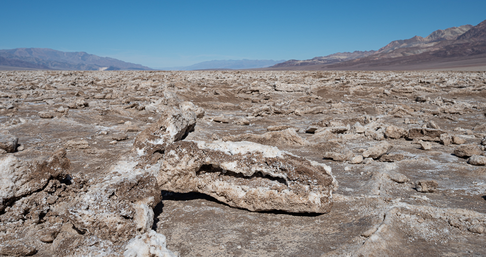
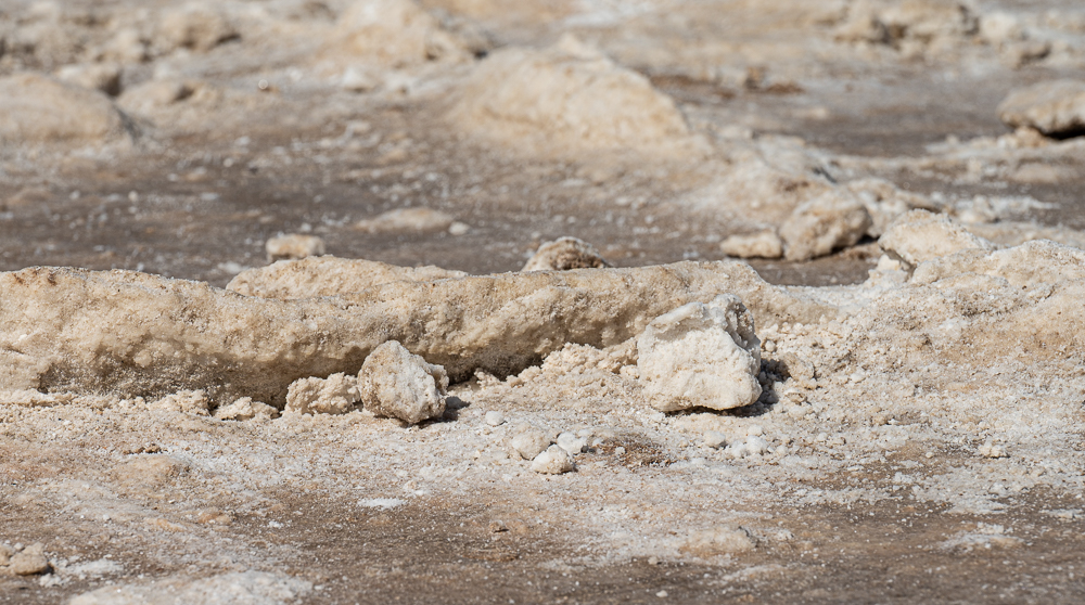
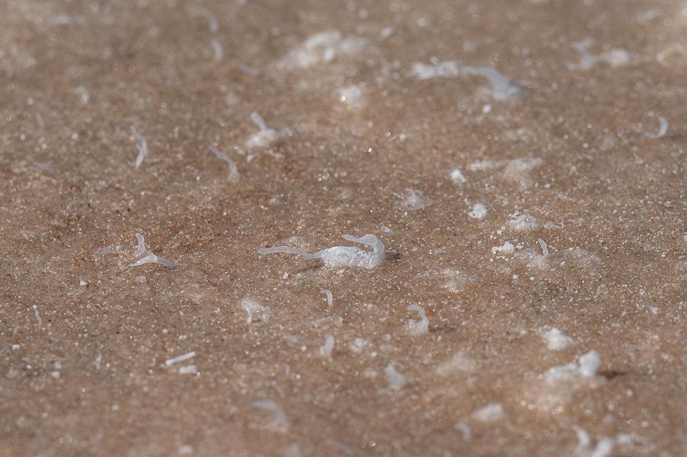
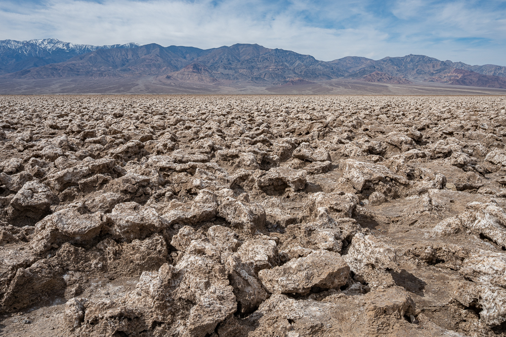
Of course we had to visit the Devil’s Golf Course – it’s just too stark and weird and inhospitable not to see.

Devil’s Golf Course

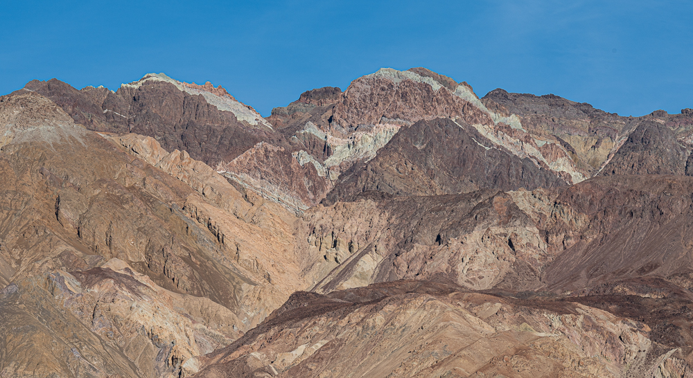
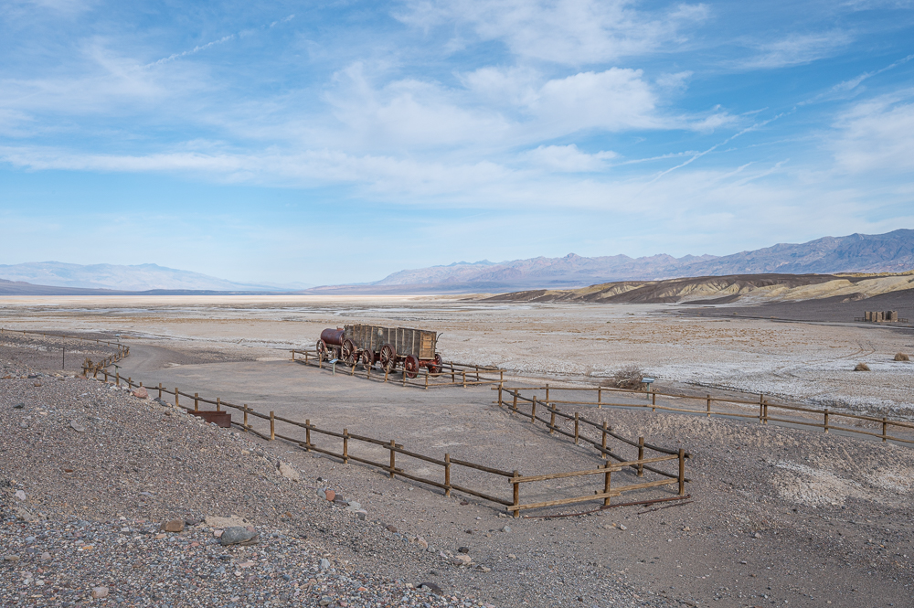
Another bit of Death Valley history happened when borax was found in the valley in the 1880s, and was mined and processed there for several years. Unfortunately, heat in the summer made processing impossible so the mine and processing was abandoned after only five years. However, the iconic “20 Mule Team” brand of borax (sold primarily as a laundry additive, but it has other uses) is still sold today, and the brand refers to the massive mule teams needed to haul the borax from Death Valley, up and over the mountains to market.

– Part of borax mule train

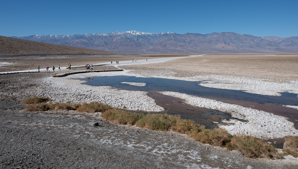
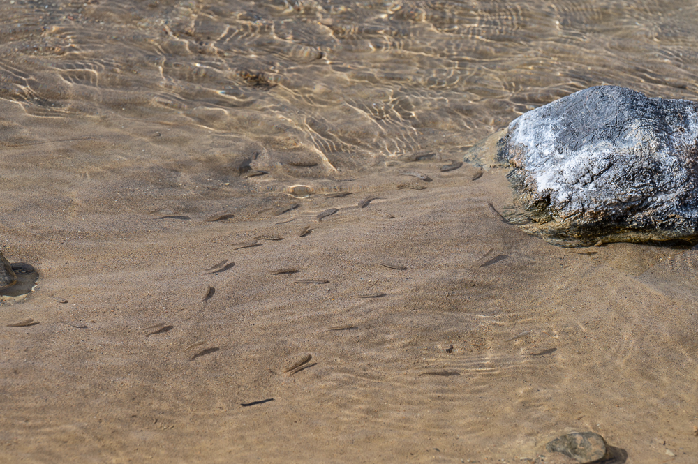
Another marvel in Death Valley’s harsh climate is the existence of natural springs and the endemic pupfish. Salt Creek is one of the few remaining wetland areas since Death Valley’s more plentiful marshes and lakes disappeared about 15,000 years ago.

Salt Creek

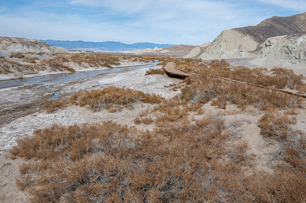
What makes the creek truly fascinating is the presence of little inch-long pupfish that have evolved to be a unique sub-species. Some other isolated bodies of groundwater in the Mojave desert also have pupfish populations, but each has evolved to adapt to its local conditions. Imagine – these little fish live in water that is 2.5 times saltier than the ocean, and where water temperatures can spike to 107 degrees (F). They may be little fry, but they’re tough!

Salt Creek Pupfish

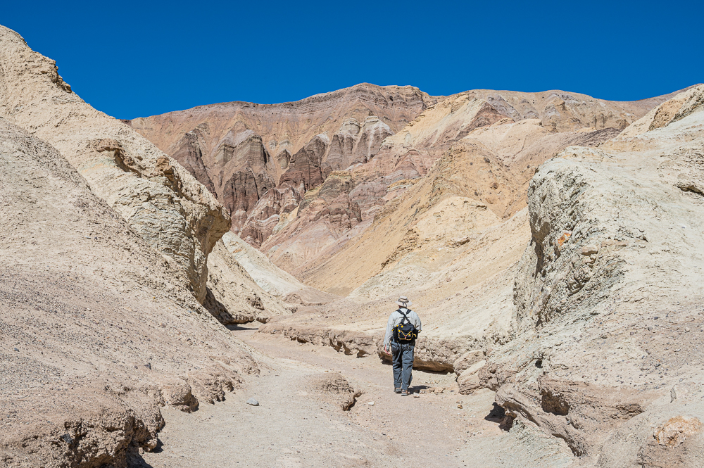
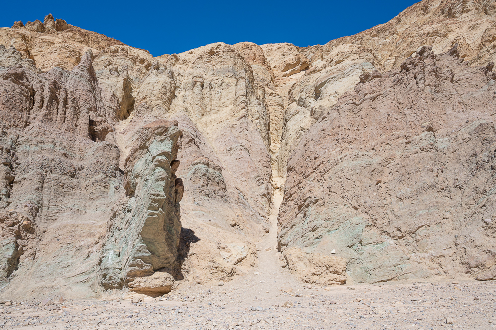
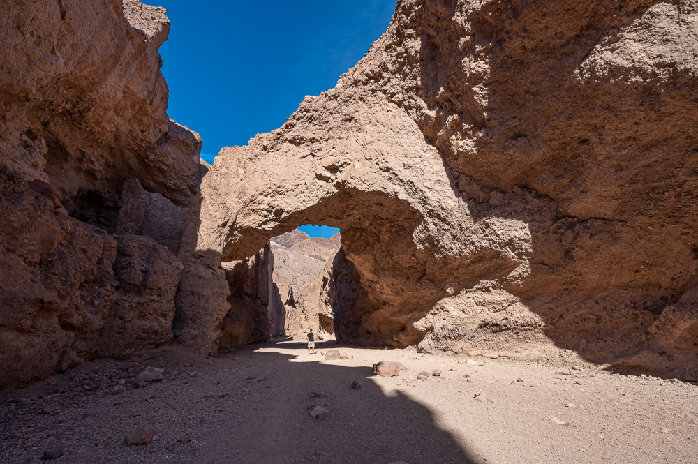
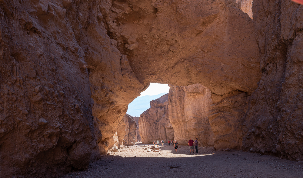
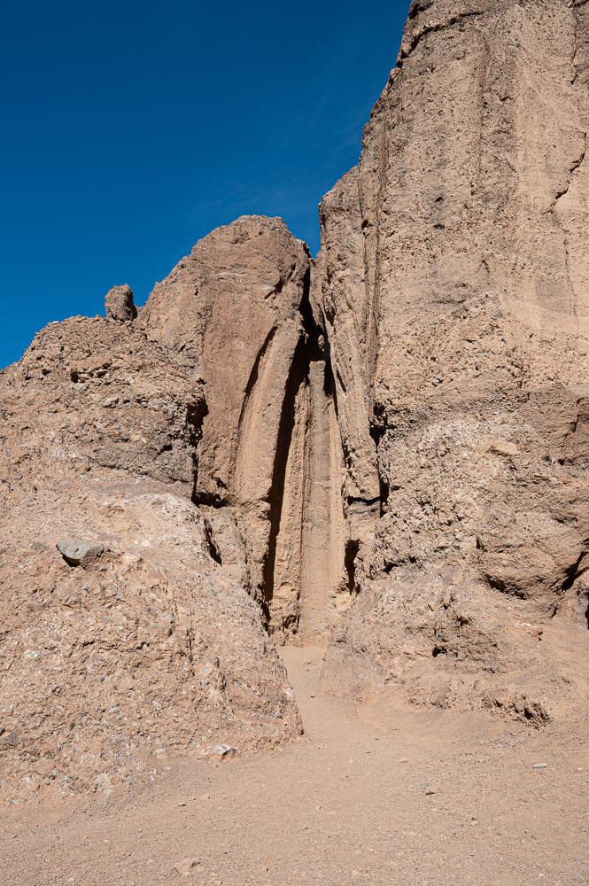
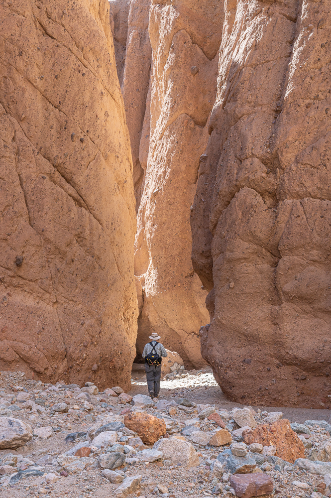
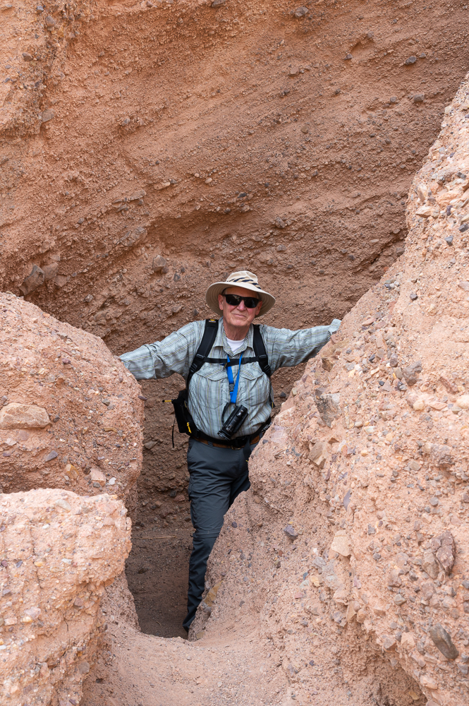
Since we’ve visited the park once before, we wanted to find new places to explore, particularly off the beaten path. A ranger recommended Room Canyon, well past all the popular spots, and towards the south end of the park.

The trailhead was vaguely located at a mile marker along the road, and the directions said to trek across open land for almost a mile and a half to find a small promontory that marks the actual canyon. The open land was cut by dry washes, rocks and scattered scrub, but we tended to stay in the larger washes and we eventually spotted the canyon’s entrance.

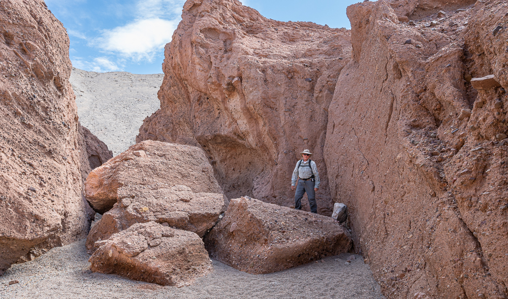
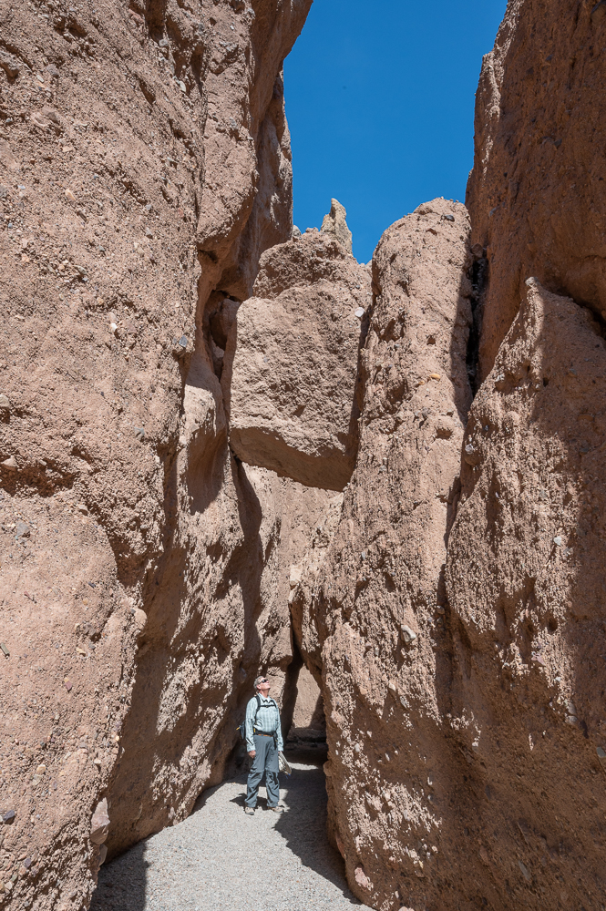
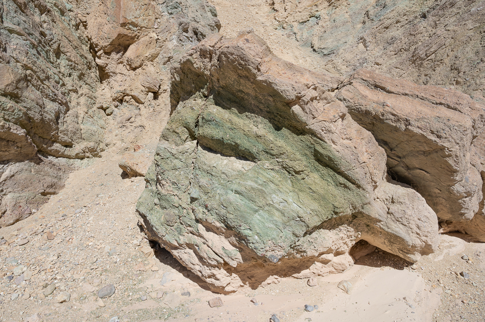
It was a really neat area, eventually opening up into a bigger space with a few wildflowers to remind us that there really is a lot of life in Death Valley.

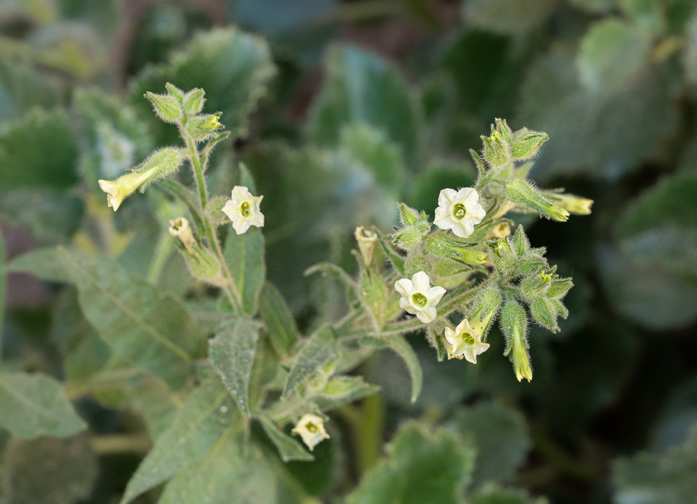
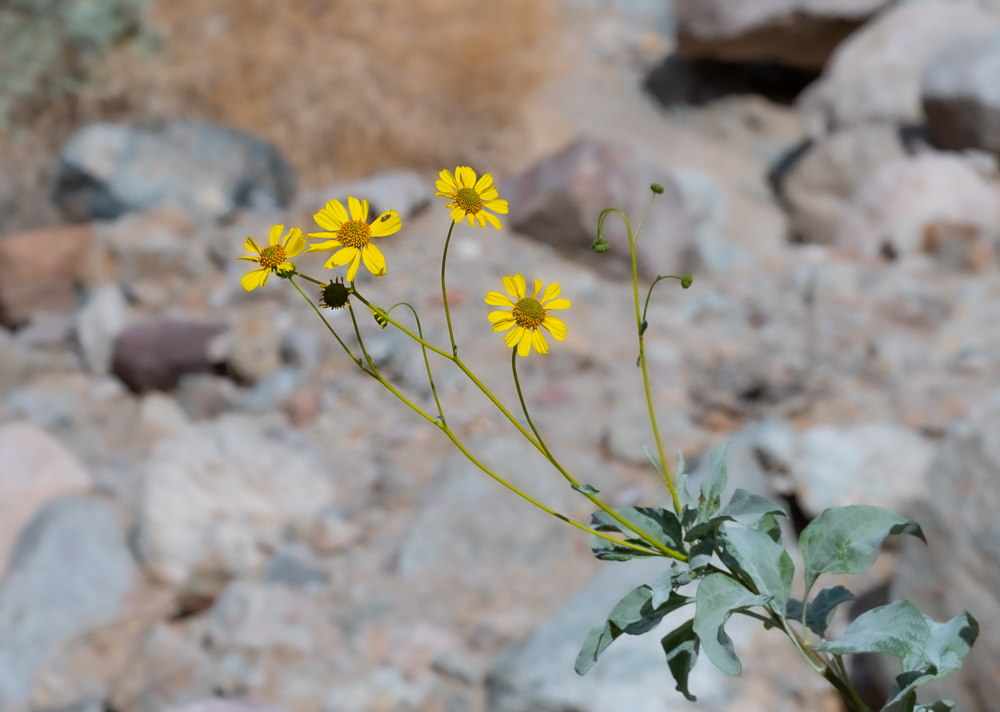
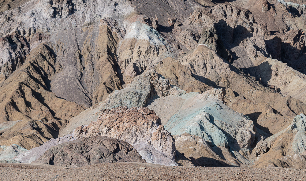
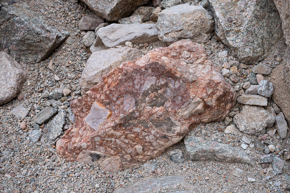
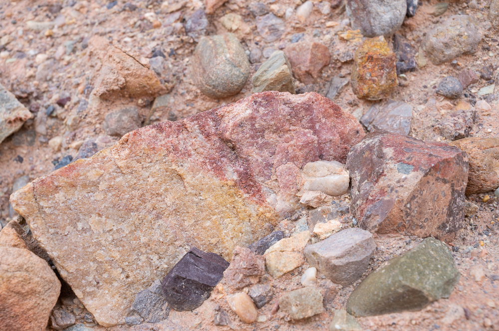
Flowers were a welcome splash of color, but the rocks continue to dazzle with interesting shapes and colors too.

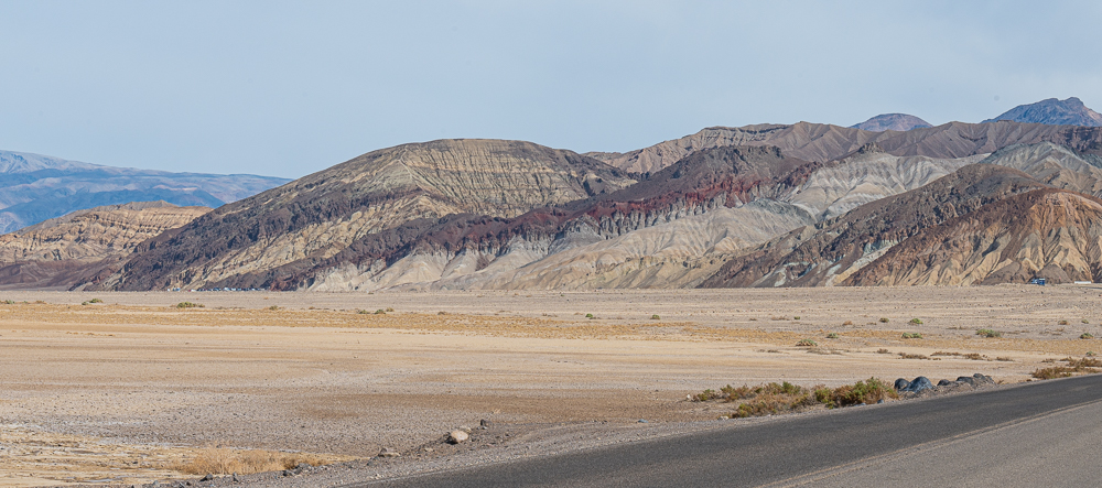
After a few hours of exploration, we decided to venture farther south, out of the park. We ran into a nice couple on another trail earlier in the week, and they recommended a visit to China Ranch – a date farm in the middle of nowhere. With the description of delicious date shakes on our minds, we set out to see if we could find some cold treats on a warm day. The drive south was gorgeous, with ever-changing colors and formations, eventually giving way to a few small clusters of scruffy civilization scattered in the desert. We followed the sun-faded signs down a twisting dirt road into an improbable barren canyon, and at the bottom, the fields of date palms were a happy surprise to see. The date shakes lived up to their billing, and we bought a pound of dates in different varieties to take home too. You just never know what you’re going to find – that’s the fun of exploring, and of following the suggestions made by nice people you meet on the trail.

Happy Jim after enjoying a date shake

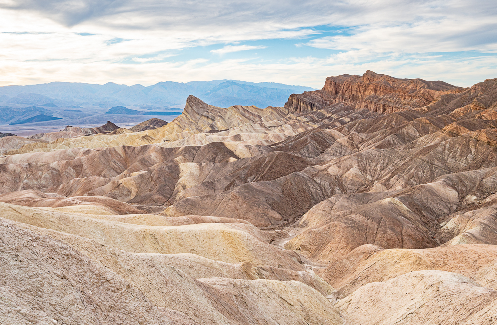
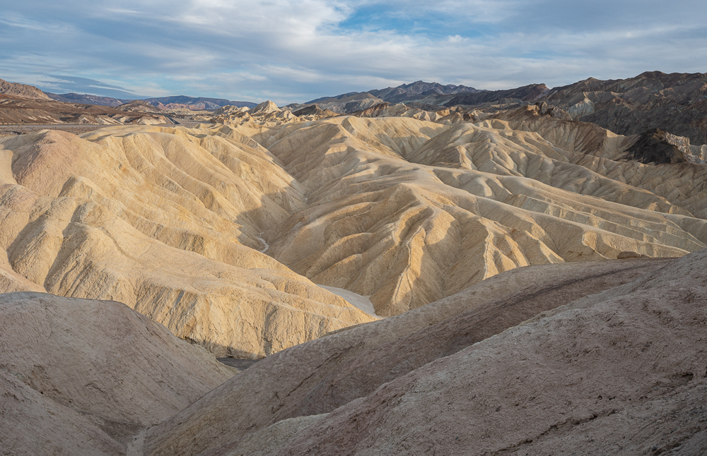
We capped off the trip with a sunset at Zabriskie Point, a nice viewpoint, probably better suited for sunrises than sunsets, but we didn’t want to get up that early.

In the next post I’ll show you a very different place about 100 miles from Death Valley – Manzanar National Historical Site. Still no bears. Stay tuned.

Death Valley – Part 2

Another post without a single bear… That’s two in a row, for those of you keeping track.

Ah, but Death Valley has so much to show us – so much beauty even in the stark landscape, the unreal colors, and the infinite ways that rocks and minerals can be arranged to create stunning and fanciful formations. Where to begin? Let’s start with the Ubehebe Crater – 600′ deep and 1/2 mile across, this monster was created when magma from deep within the earth hit ground water, causing a massive explosion of steam and hot gasses. The event that formed Ubehebe occurred as recently as about 2,100 years ago – a little too recent for comfort!

There are a few trails down into the crater, but we chose to hike the rim instead, since hiking on fine cinders is hard enough without a very steep slope on a hot day. In the photo below, this nearby smaller crater is Little Ubehebe, and if you look closely, you can spot the two people on the trail leading to it, on the right. It’s difficult to grasp the scale of things in this 140-mile-long park.

60 miles south of Ubehebe Crater is the trailhead for a popular hike – Golden Canyon, nearer to the main Park Service ranger station centrally located at Furnace Creek. The contrast in colors and formations is striking, and that’s what makes Death Valley so special – the incredible variety.

Narrow side canyons off the main canyon beg to be explored, and it’s easy to appreciate how terrifying this place would be during a flash flood event. Our imaginations were on overdrive – so many things to wonder about this landscape, especially the chemistry that produces so many soft colors in the rocks.

Not too far down the road from Golden Canyon is a short hike to see a Natural Bridge. Can you spot the man standing underneath for scale? It was also a perfect spot to get some welcome shade on a 90 degree afternoon.

Imagine the velocity of flooding rain that form the carved falls like the one pictured below! A couple of people could stand together at the bottom of the curved vertical pipe.

Death Valley becomes almost impossible to visit starting in April and lasting into October, due to the extreme temperatures. The record was 134 degrees (F) at the aptly named Furnace Creek, and daytime highs in the summer are routinely over 110 degrees.

At 282′ below sea level, Badwater Basin is the lowest point in North America, and I think the landscape there best fits the image conjured by the park’s name.

You can walk out to explore a tiny part of the 200 square miles of salt flats in the park at Badwater. The well-worn path from the parking area is salty white where mud deposits are loosened by foot traffic and blown away by the wind, revealing the salt beneath.

The real secret is to take a few careful steps beyond the worn path and look for the hidden gems… like these tiny salt formations, each about the size of a grain of rice. Such fanciful shapes – easily trampled, easily missed.

Late afternoon is a perfect time to cap the day by driving the nine mile loop called Artist Drive, as the western sun really lights up the fantastical colors of the rocks.

And there is still more to show you from Death Valley… stay tuned. Yes, there are more bear-free posts on the way.

A Road Trip – Death Valley, Part 1

We shoveled the snow and endured the cold rain and decided it was time to take a road trip Down South (which is how Alaskans refer to anywhere in the Lower 48). We visited Death Valley a few years ago and loved it, so we decided to go back and enjoy it some more…

Located in the southeastern part of California and along the Nevada border, Death Valley advertises itself as the hottest, driest and lowest national park in the U.S. Despite the forbidding name, it’s a sensational place full of mind-blowing shapes and formations, soft pastel colors, craters, sand dunes, curious canyons, a small rare fish that lives in hot salty water, and other forms of life below sea level in the middle of the desert. Death Valley is also a Dark Sky park – known for having almost no light pollution to disturb star gazing.

The nights were pleasant for star gazing, and we lucked out and had no moonlight for a few days so we could see the milky way. The days were in the mid 70s, though we had three afternoons that hit 90 – a little toasty, but we shouldn’t complain after the cold winter we’ve had. The trick is to find narrow canyons to hike when it’s hot in the afternoons, so there’s plenty of shade.

It’s quite a “chariot ride” to drive to Death Valley, climbing up steep grades up to 5000′ or more, then down the steeps into a vast flat valley – Panamint Valley… then up the mountains on the other side, and down again to make an almost straight drop into Death Valley. Whew!

We started with an exploration of a more remote part of the park’s western side – Emigrant Canyon. It’s an area where individuals used to mine for gold, lead and silver, and there were once two small towns in the region. It’s a very different from the rest of the park and not very well visited except by wild burros.

The tiny homestead in the photo below was occupied and mined by a man for about 40 years – can you imagine living and working (mostly) alone in this place for that long?

What amazes me is that explorers and entrepreneurs knew how to find these minerals, and were willing to scour the harsh landscape to look for them.

Miles past this area we found a set of 10 charcoal kilns in Wildrose Canyon. Each of these 25′ high kilns were built in the 1870s to produce charcoal from local trees (which were plentiful in that particular area) for smelting lead and silver. Sadly, they were only used for just a few years. It’s a long way to drive to find them, but it was worth it!

We finished up our first day by hiking up Mosaic Canyon, with its smooth walls of dolomite to scramble up and slide down.

I just fell in love with the pastel colors in the rocks, particularly the soft greens. The landscape is so otherworldly – appropriate since some scenes in the original Star Wars movies were filmed here. It’s easy to let your imagination see all kinds of exotic science fiction settings among the formations.

We tried a new hike – up Titus Canyon. Tall vertical walls and a narrow pathway made us feel so small… and then we bent our minds trying to imagine the forces that created the canyon and the conglomerate rocks in it.

Oh, there’s lots more to show you in Death Valley – stay tuned.