In the early 90s we were in graduate school at the University of Utah in Salt Lake City, and that gave us an opportunity to explore some of the wondrous parks in the southern part of the state. Arches National Park was always our favorite, with glowing red rock in surreal formations. There are over 2000 arches in the park, though we only saw about 15 of them since many are difficult to access.
The landscape was formed by deposits of sand and silt many millions of years ago when the state was part of a massive inland sea, drying and flooding multiple times. Sandstone formed over salt domes, and the domes eventually bulged, causing the rock to crack in parallel lines. Water and wind began the erosion process, shaping rock into fins and dissolving some of the “glue” between grains of Entrada sandstone to form arches… like the Window arches…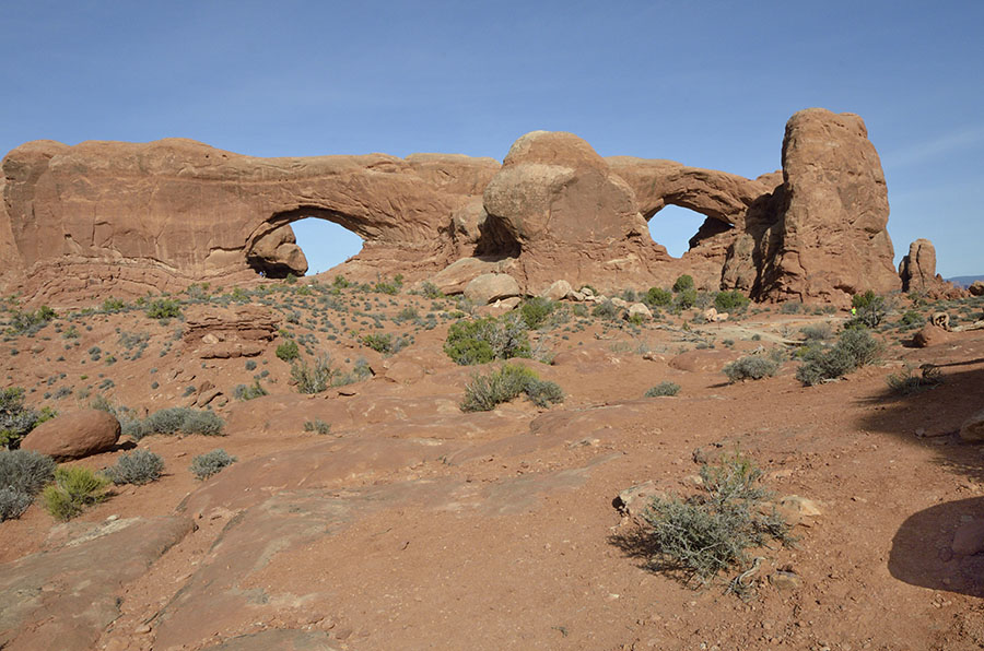 …the Landscape arch…
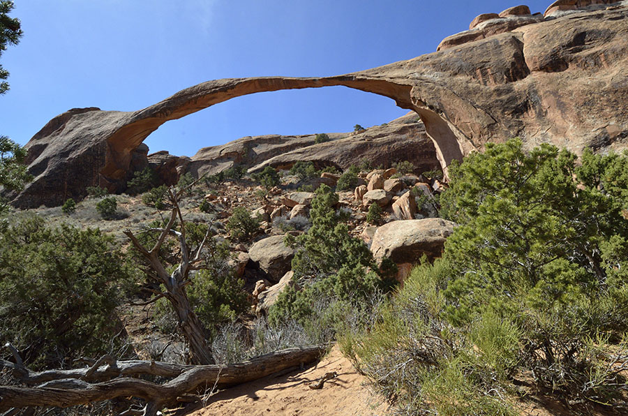 …and the iconic Delicate arch, just to name a few.
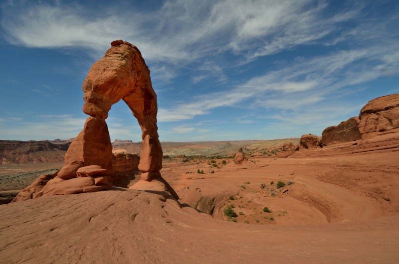 Geologic forces are also responsible for shaping Arches, starting with the Moab Fault which split the rock face and shifted the west side 2600′ higher than the east side.
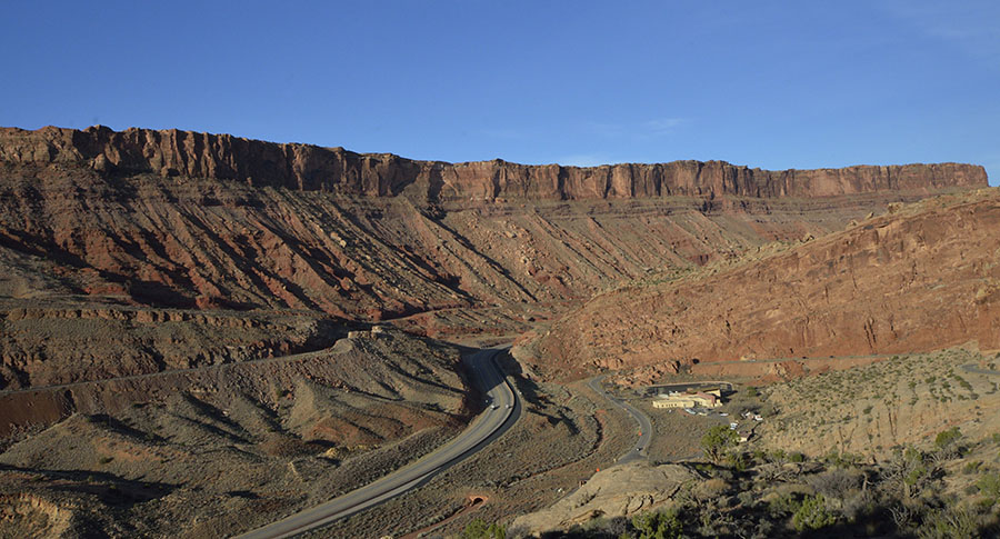 The road just outside the park follows the fault, which means that if the earth starts to shift again it could make for some dicey driving! In addition to arches, flat panels of sandstone stand proudly in the landscape such as Park Avenue…
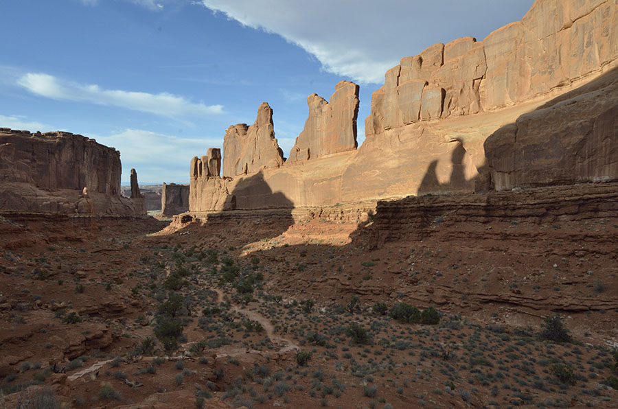 …and the Courthouse.
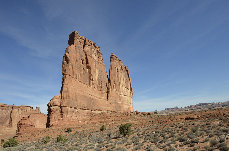 Balanced Rock is another well-known formation – we’re always glad to see its 128′ still standing…
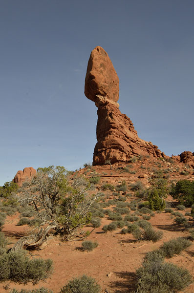 …and we keep wondering what the Three Gossips are whispering about.
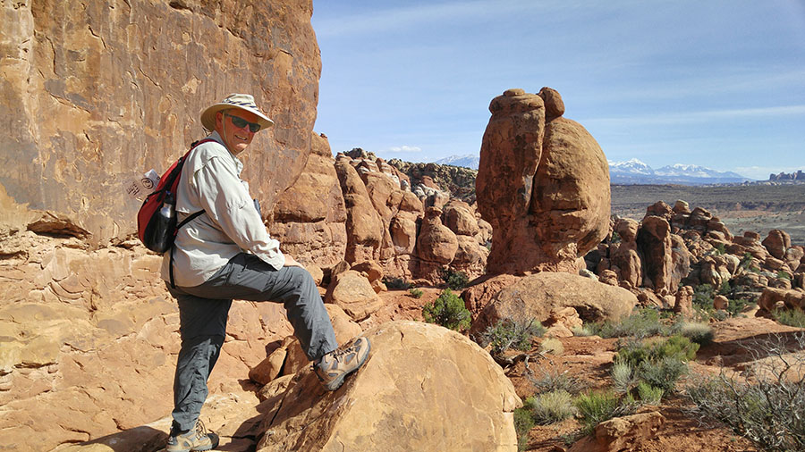
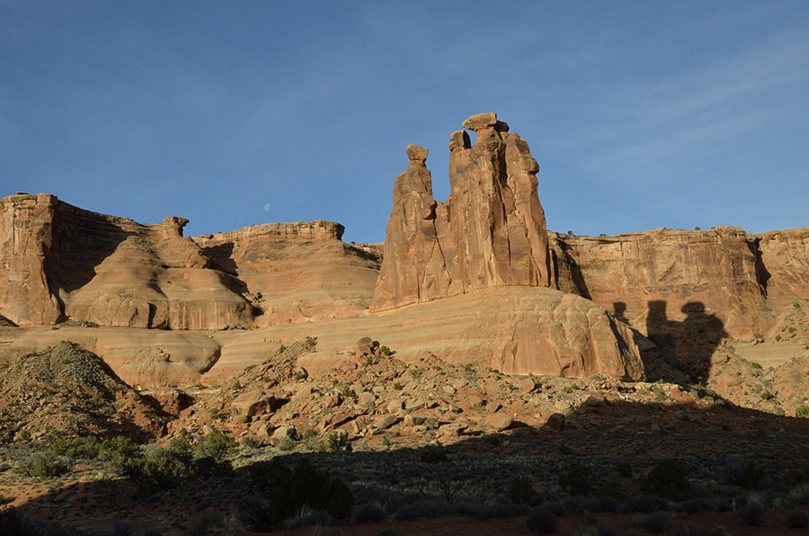 While some of the arches are easy to get to and lots of fun to climb around, such as the Double Arch…
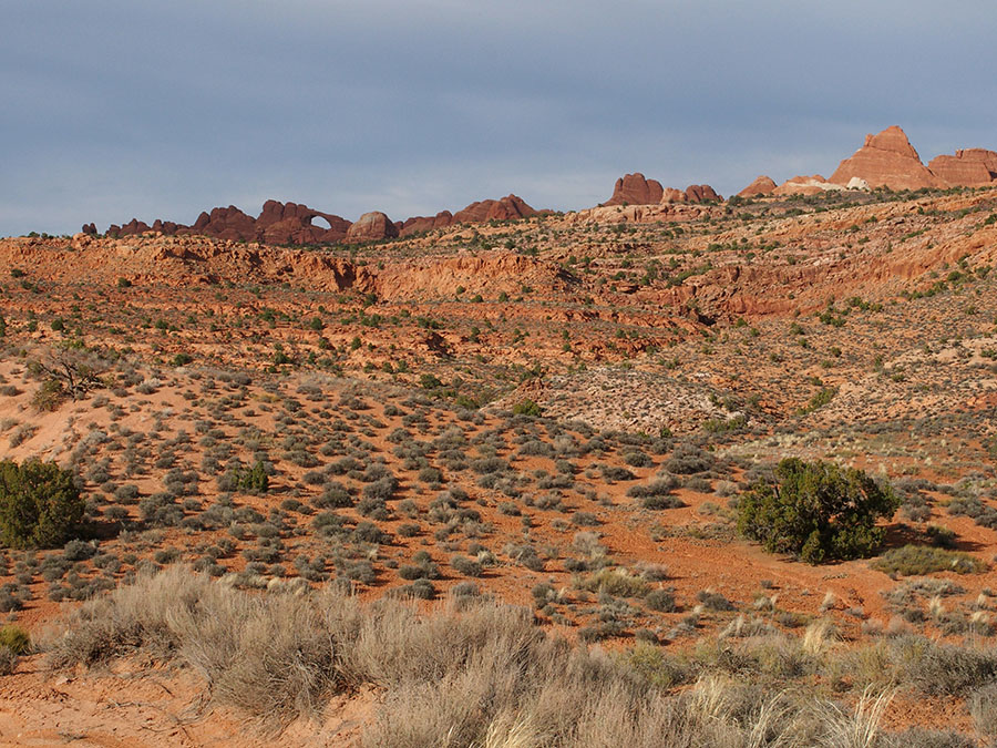
 …some are a short hike through the improbable landscape at the Devil’s Garden…
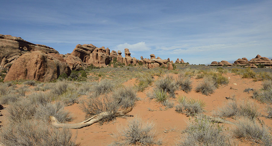 …to see the Sand Dune arch…
 …and the Broken arch.
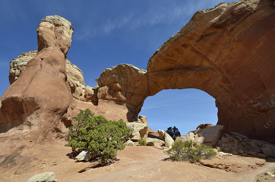 We also wanted to see some of the more remote arches, and first on our list was Tower arch. This arch can be reached by a very rocky 4-wheel drive road and a short hike (we found the road to be too rough for us) or a 9 mile dirt road and a moderately difficult 2.5 mile hike, scrambling up to a rock ridge and a brutal slog on a few steep sand dunes – but it was worth it! Can you spot Jim under the arch?
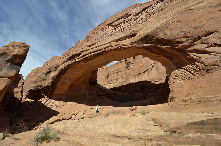 The view from the arch to the west was gorgeous, and we loved scrambling around underneath it.
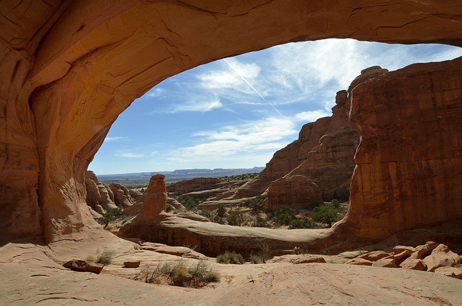 The next day we got a backcountry permit to venture into the Fiery Furnace area – a more challenging part of the park requiring a lot more rock scrambling, where trails don’t exist, and with a risk of getting disoriented. We took it slowly and carefully, backtracking often to find our way among the tall fins to discover a small arch we could crawl through, and eventually we found Surprise arch after making our way carefully along a narrow ledge.
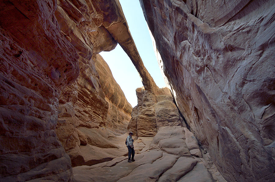
 Arches never ceases to amaze and delight with its many shapes and hidden treats, and I think it’s still our favorite of Utah’s treasures.
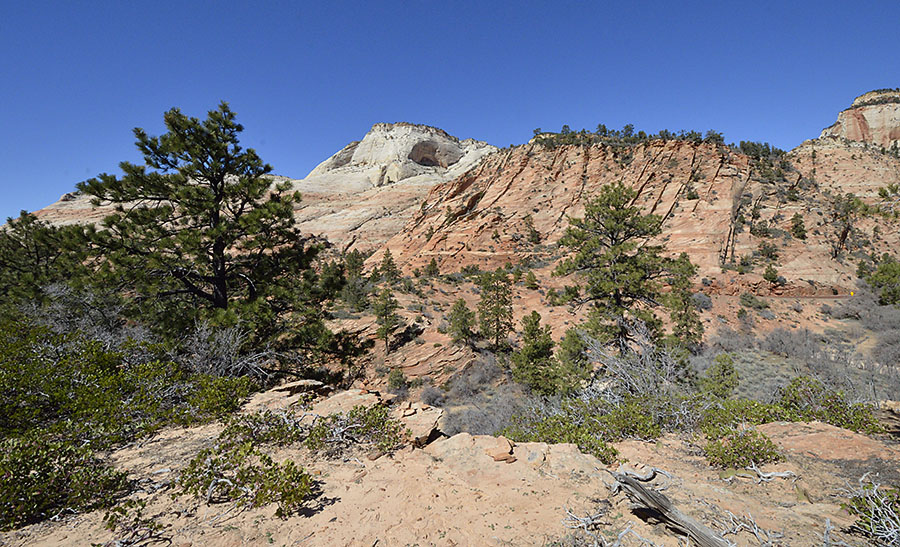 We found the east side to be much less crowded, and although there are few formal hiking trails there is plenty of territory to explore off the beaten path. Our favorite exploration scrambled down into a wash with steep walls shaped by raging water.
 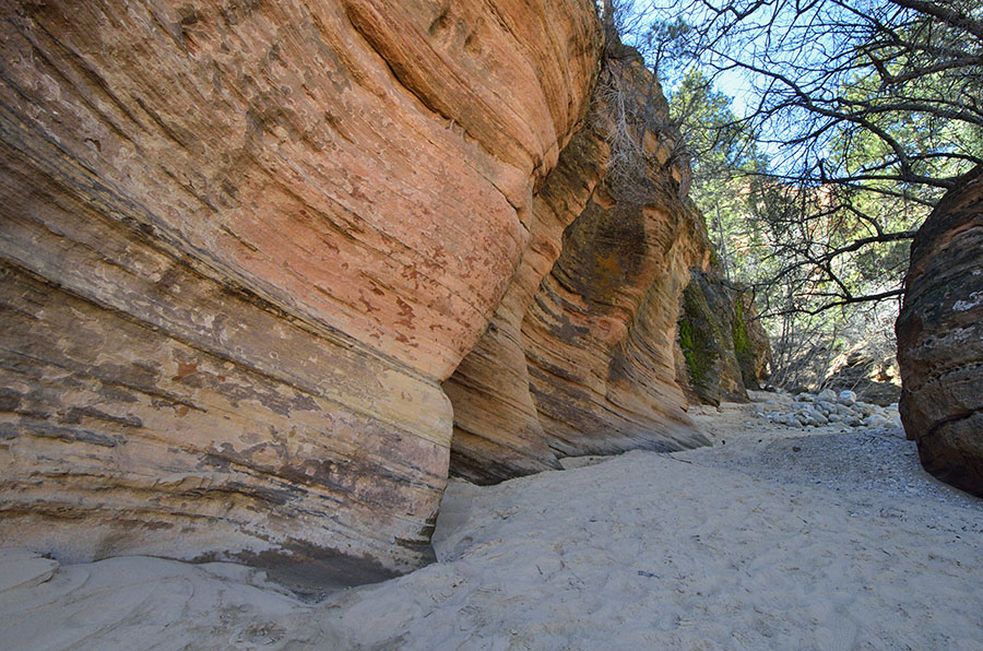 With clear skies and weeks without rain in the forecast we felt safe down there, finding interesting rocks and shapes in the sandstone that showed the effects of wind and water. Rocks look like waves or ripples on a beach!
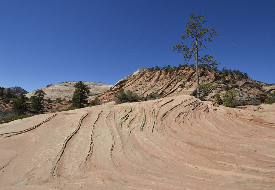 We had a steep scramble to get out of the wash and back up to the road, but we had the entire area all to ourselves and we loved having some quiet time to enjoy the landscape.
 After a brief snowball fight near Checkerboard Mesa, we spotted a hoodoo (rock spire) up on a hillside, so we found a place to park and headed up the slickrock to check it out.
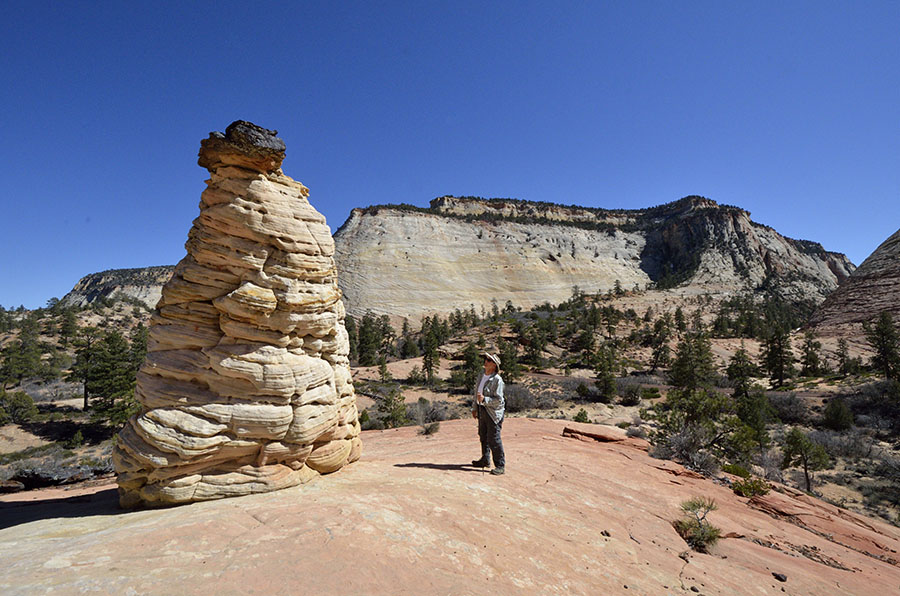 We couldn’t figure out what caused the black on top of the hoodoo, but there were other chunks of the black rock nearby that really popped against the red and yellow sandstone.
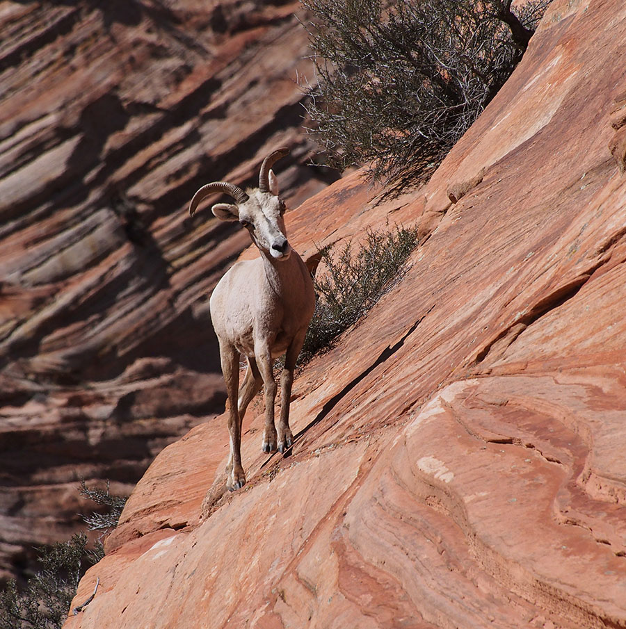
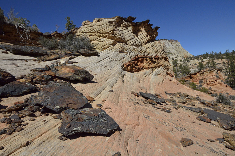 A few other spots caught our eyes and we had a ball wandering around the odd landscape, wondering at the forces of nature that created this amazing place in the high desert. But there was one final treat – desert bighorn sheep! Just as we were driving back towards the tunnel, we spotted a small herd of sheep on the mountainside that stayed around long enough for me to change lenses and get to a good vantage point.
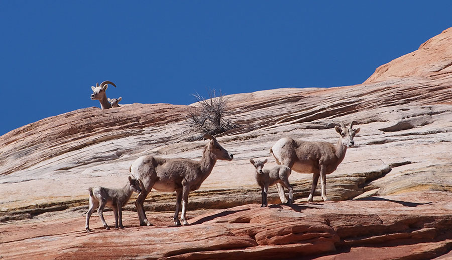
 There were several lambs…
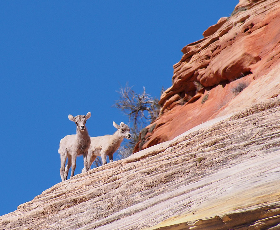 …and they wagged their tails like crazy when they could get their mother to pause long enough for them to nurse.
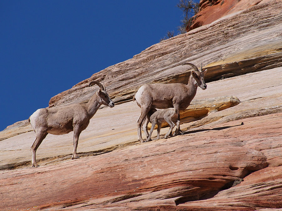 Wonderful! It was the perfect way to wrap up our first visit back to Zion in 25 years.