Another post without a single bear… That’s two in a row, for those of you keeping track.
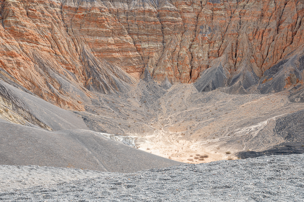
Ah, but Death Valley has so much to show us – so much beauty even in the stark landscape, the unreal colors, and the infinite ways that rocks and minerals can be arranged to create stunning and fanciful formations. Where to begin? Let’s start with the Ubehebe Crater – 600′ deep and 1/2 mile across, this monster was created when magma from deep within the earth hit ground water, causing a massive explosion of steam and hot gasses. The event that formed Ubehebe occurred as recently as about 2,100 years ago – a little too recent for comfort!
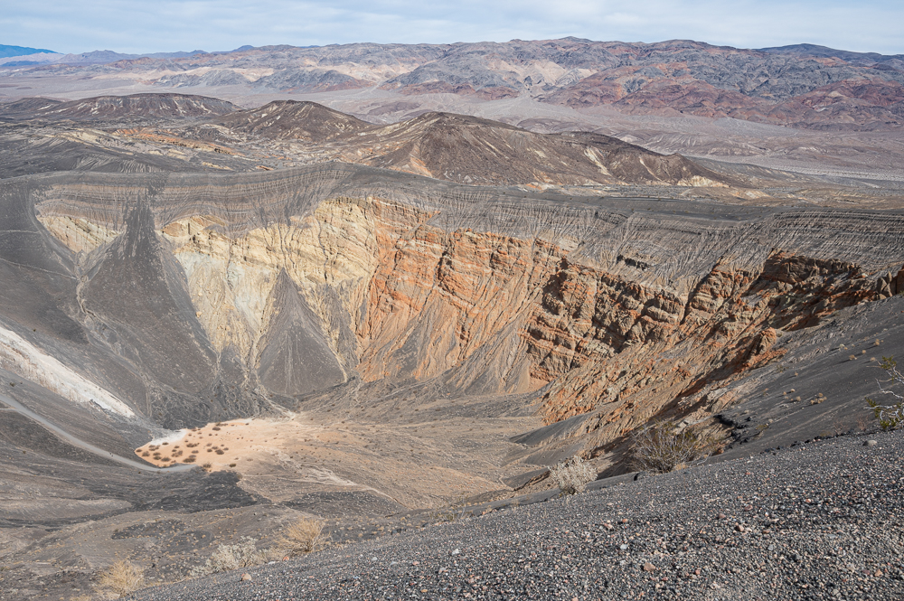
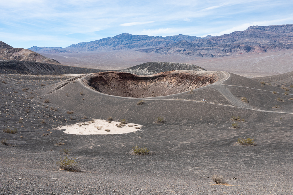
There are a few trails down into the crater, but we chose to hike the rim instead, since hiking on fine cinders is hard enough without a very steep slope on a hot day. In the photo below, this nearby smaller crater is Little Ubehebe, and if you look closely, you can spot the two people on the trail leading to it, on the right. It’s difficult to grasp the scale of things in this 140-mile-long park.
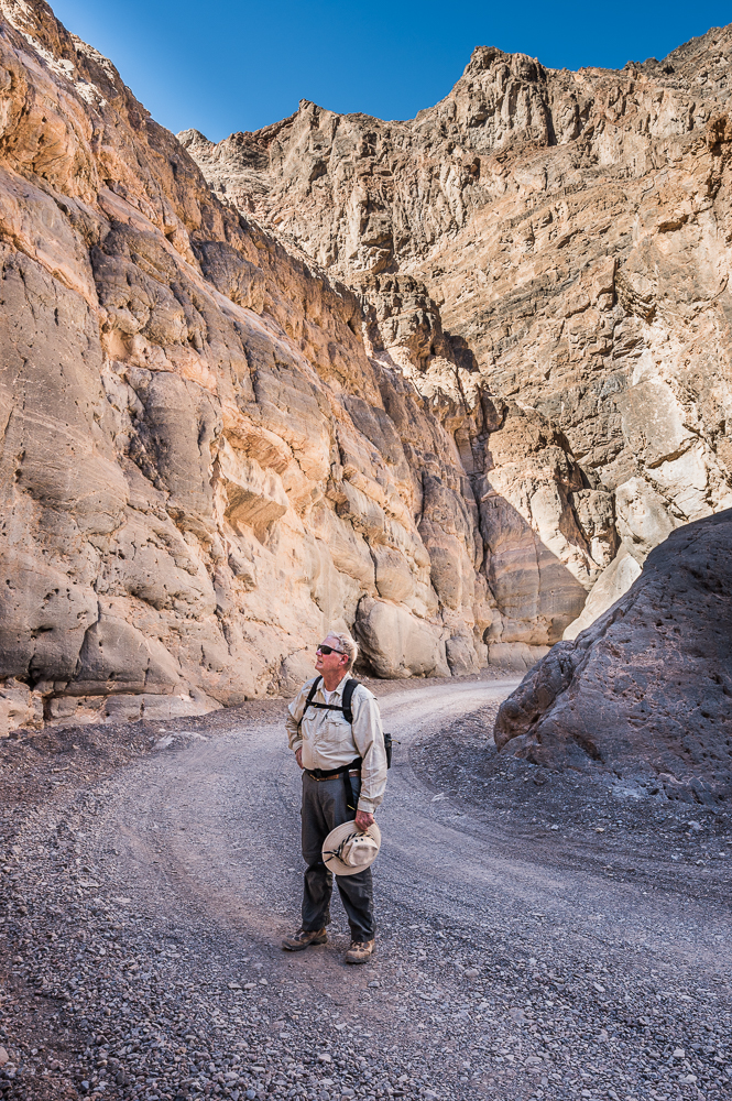
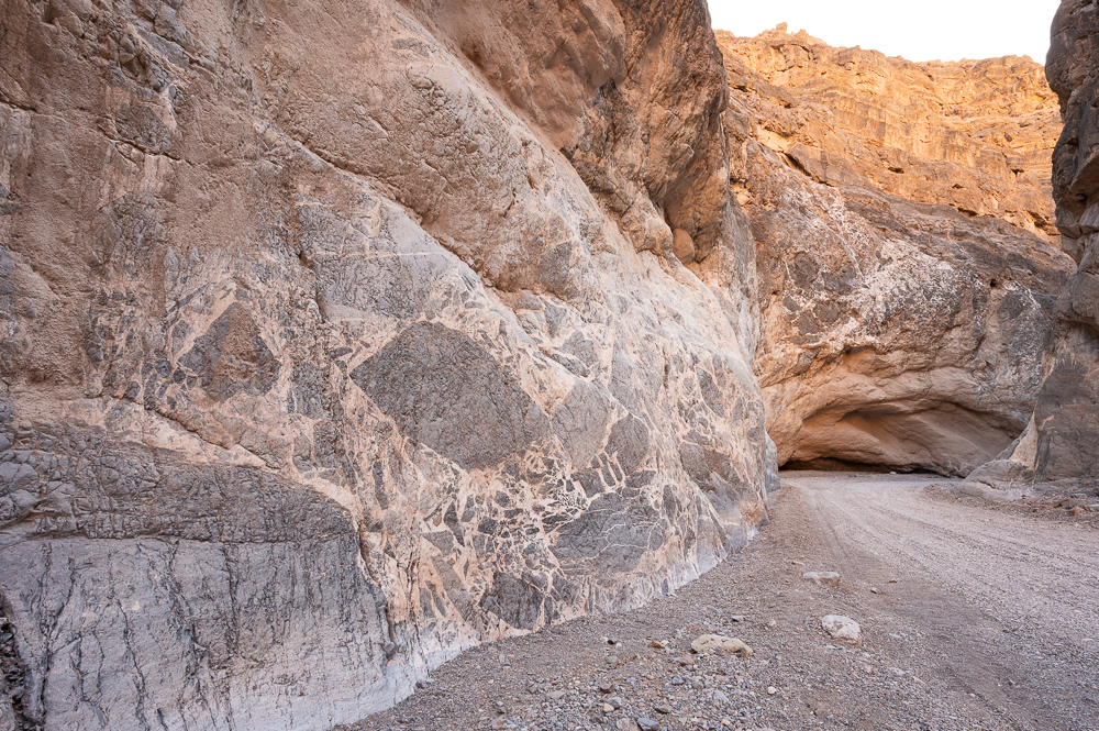
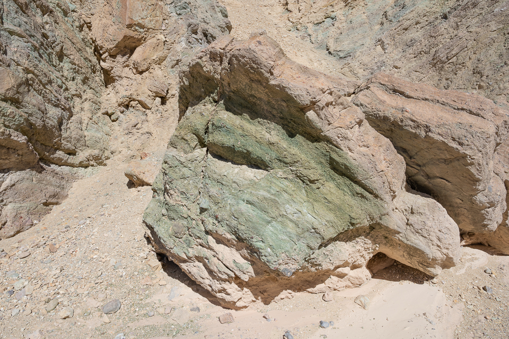
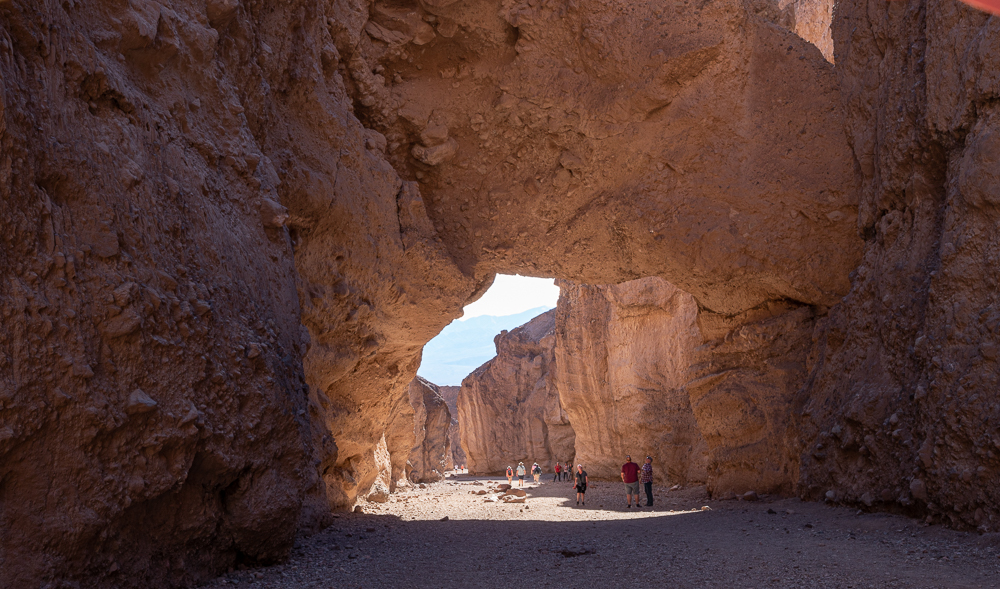
60 miles south of Ubehebe Crater is the trailhead for a popular hike – Golden Canyon, nearer to the main Park Service ranger station centrally located at Furnace Creek. The contrast in colors and formations is striking, and that’s what makes Death Valley so special – the incredible variety.
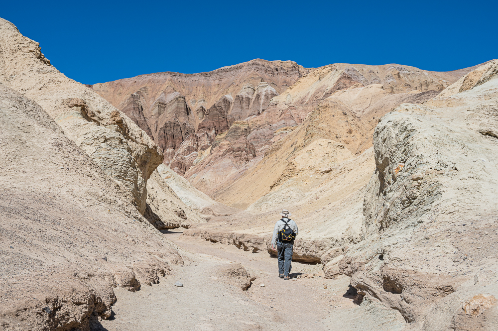
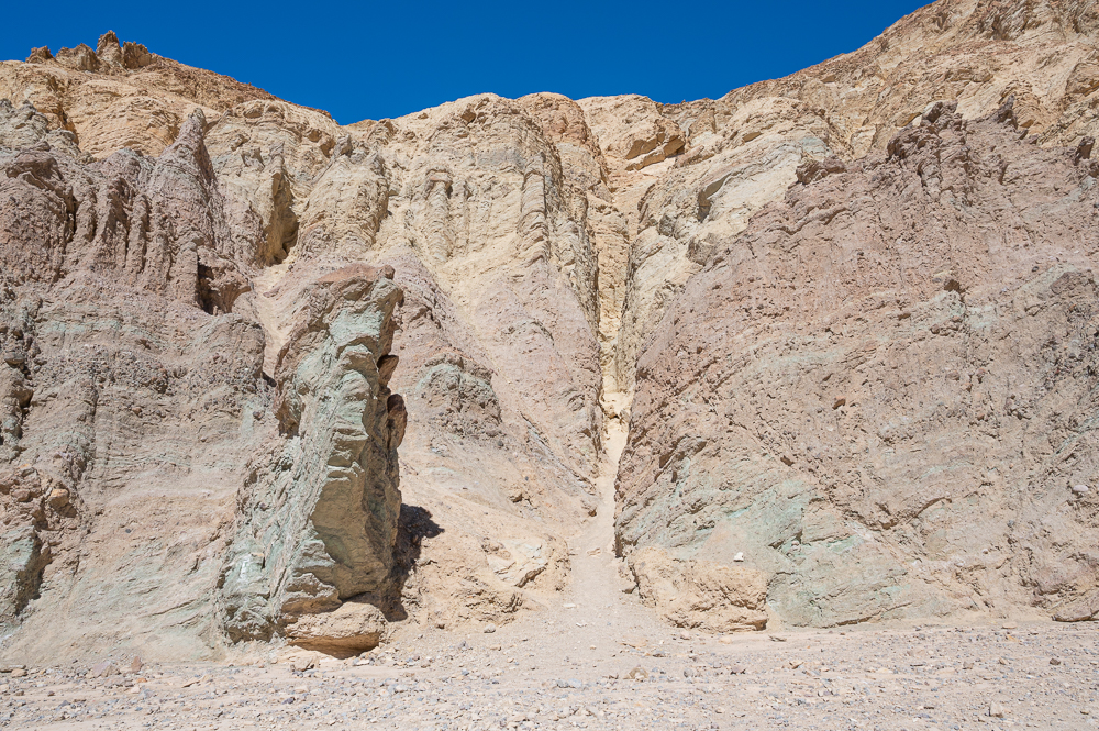
Narrow side canyons off the main canyon beg to be explored, and it’s easy to appreciate how terrifying this place would be during a flash flood event. Our imaginations were on overdrive – so many things to wonder about this landscape, especially the chemistry that produces so many soft colors in the rocks.
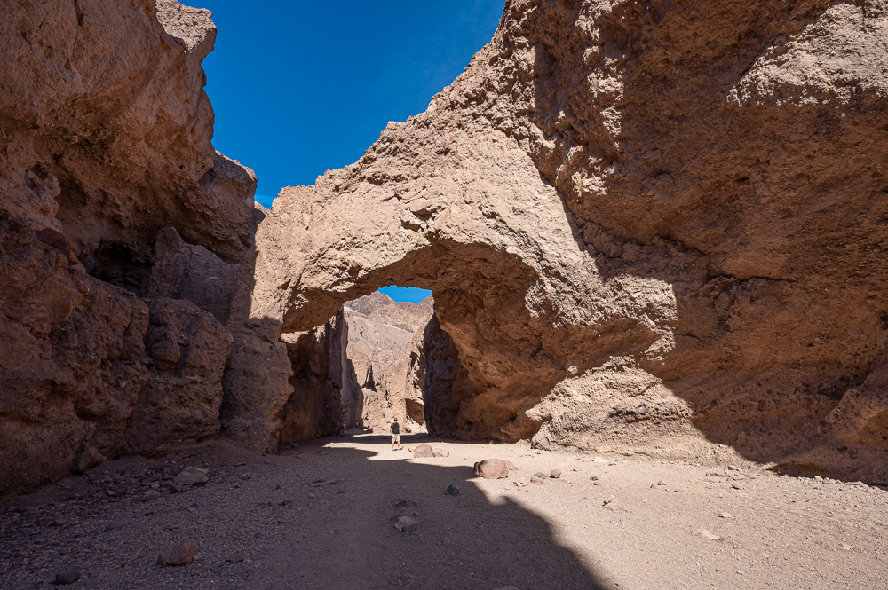
Not too far down the road from Golden Canyon is a short hike to see a Natural Bridge. Can you spot the man standing underneath for scale? It was also a perfect spot to get some welcome shade on a 90 degree afternoon.
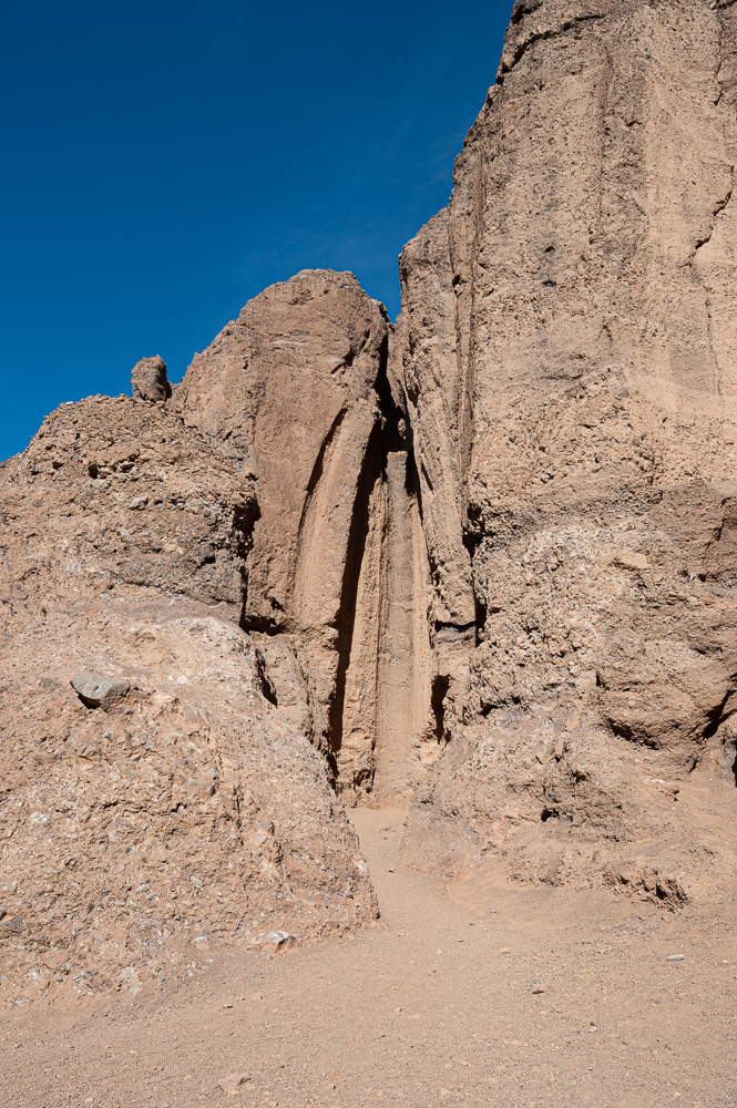
Imagine the velocity of flooding rain that form the carved falls like the one pictured below! A couple of people could stand together at the bottom of the curved vertical pipe.
Death Valley becomes almost impossible to visit starting in April and lasting into October, due to the extreme temperatures. The record was 134 degrees (F) at the aptly named Furnace Creek, and daytime highs in the summer are routinely over 110 degrees.
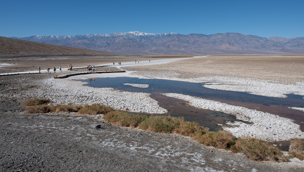
At 282′ below sea level, Badwater Basin is the lowest point in North America, and I think the landscape there best fits the image conjured by the park’s name.
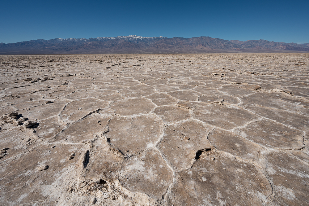
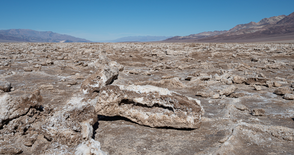
You can walk out to explore a tiny part of the 200 square miles of salt flats in the park at Badwater. The well-worn path from the parking area is salty white where mud deposits are loosened by foot traffic and blown away by the wind, revealing the salt beneath.
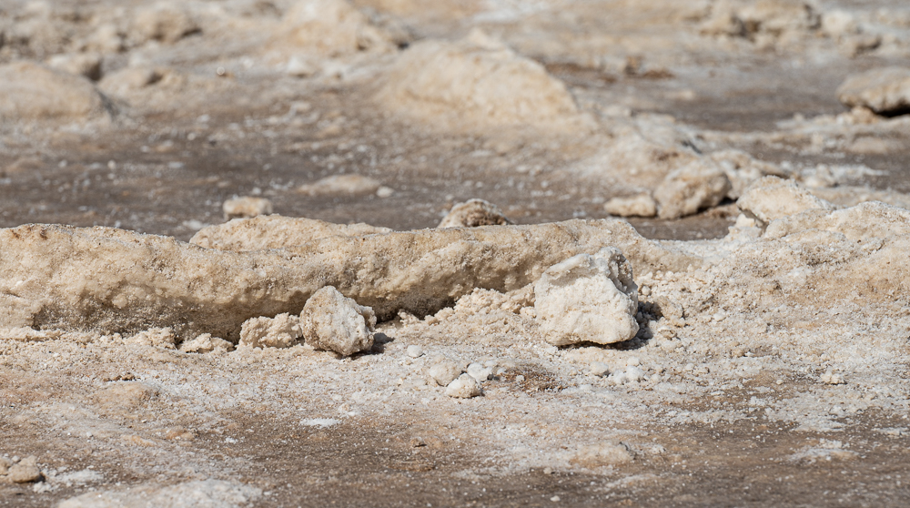
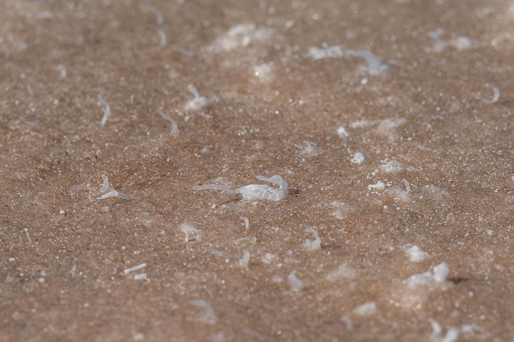
The real secret is to take a few careful steps beyond the worn path and look for the hidden gems… like these tiny salt formations, each about the size of a grain of rice. Such fanciful shapes – easily trampled, easily missed.
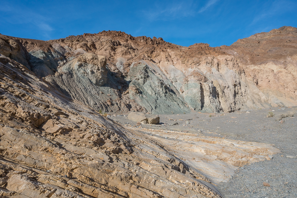
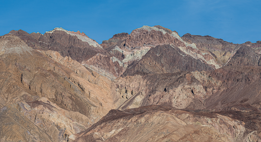
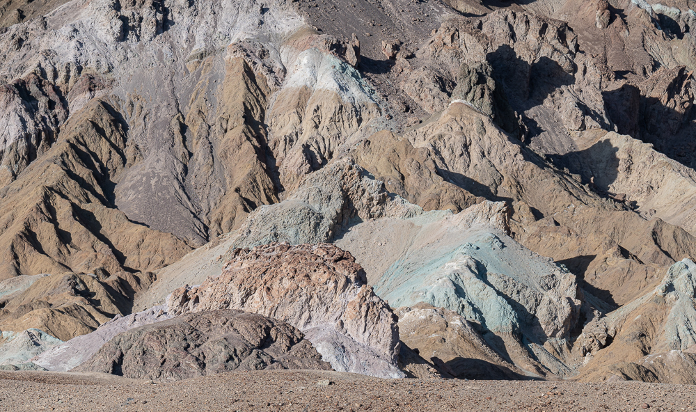
Late afternoon is a perfect time to cap the day by driving the nine mile loop called Artist Drive, as the western sun really lights up the fantastical colors of the rocks.
And there is still more to show you from Death Valley… stay tuned. Yes, there are more bear-free posts on the way.