Cruising around interesting places all over the Alexander Archipelago (also known as southeast Alaska), sometimes we forget how good we have it right at home. Mitkof Island is pear-shaped, about 10 miles wide at its widest by 17 miles long, with Petersburg located on the northwest tip.
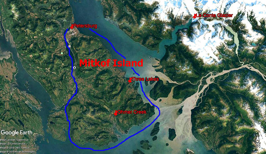
Most of Mitkof is part of the massive Tongass National Forest, and some parts of the island were logged in the 1960s and early 70s. Logging roads are still maintained by the Forest Service to provide access for recreation – such as the Three Lakes area and one of my favorite easy hikes on the island – Ohmer Creek.
After cruising all summer, returning to the hustle and bustle of town was a little overwhelming so I took advantage of a beautiful day to head Out the Road with cameras and drone for some hiking, flying, and berry picking.
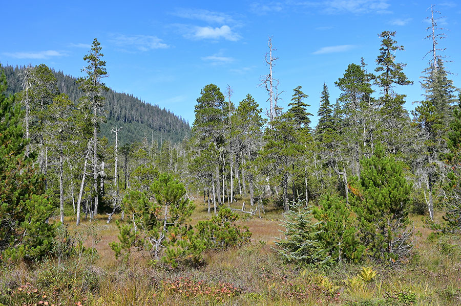
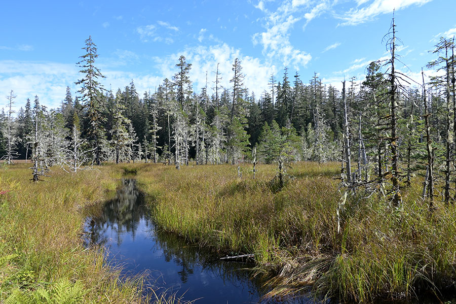
My first stop was to the middle of the Three Lakes – named Sand, Hill and Crane. The lakes are connected by trails, and Hill Lake also has a spur trail that runs down to Ideal Cove. Moose, black and brown bears, porcupines, grouse and deer are the most common animals on the island, though I didn’t encounter any this particular day. (Usually we see more deer in town than Out the Road.)
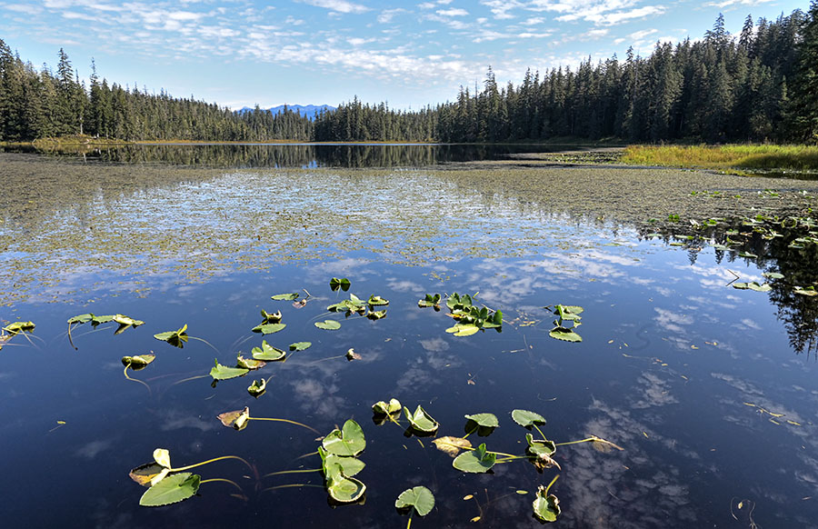
The Forest Service built a little dock complete with a rowboat and a picnic table at each lake, and in the video below you can see some of the boardwalk where the connecting trail traverses the squishy muskeg. The video starts at Hill Lake, flies south to Crane Lake, then north to Sand Lake. As the drone gains altitude you can see the panorama of the Coastal Mountain range as well as the entrance to the Le Conte Glacier inlet.
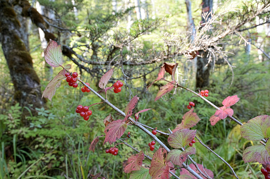
After flying and a picnic lunch, I spent a little time picking red huckleberries and high-bush cranberries. A friend makes a delicious homemade ketchup from the high-bush cranberries, so I wanted to get enough to try making some of my own.
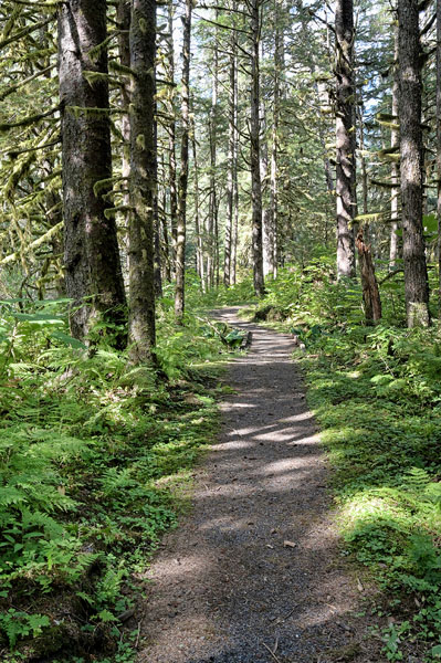
The drive along the logging roads is so beautiful, coming around a bend and seeing a distant snow-capped mountain framed by trees, or savoring the sunlight dappling the forest understory.
Before heading back to town I decided to hike part of a favorite trail – Ohmer Creek (marked on the map at the top).
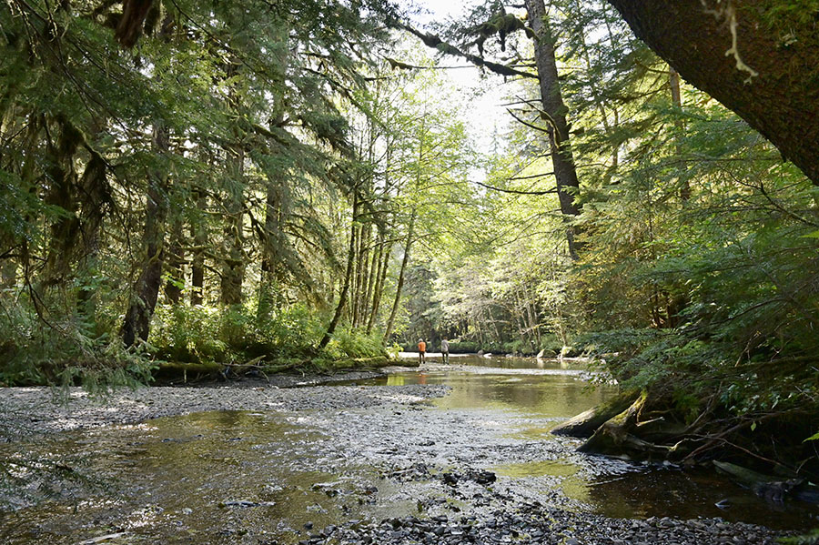
Venturing along the creek in one direction I found some humpy (also called pink) salmon trying to make their way upstream in the shallow water. You can just see the humps on their backs sticking above the water.
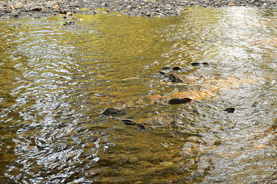
I was surprised that I didn’t see any bears – I must have just missed them because these fish were easy pickings. After hanging with the salmon for a while I headed in the other direction, into the thicker forest.
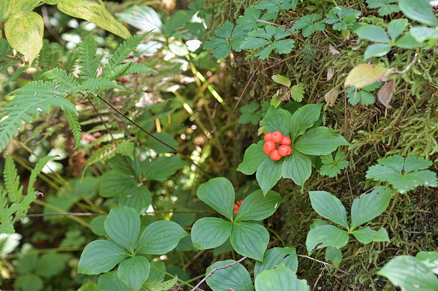
The bunchberries (also called dwarf dogwood) were ripe all over the place – they’re edible, though they’re not tasty to eat.
I launched the drone and got a terrific bird’s eye view of the creek, the muskeg, the mountains and the endless forest. The drone offers such a different look at familiar things, and makes me fall in love with this place even more. Sometimes it’s hard to believe that we get to live here.
I am all caught up now. Your flying and editing brings a wonderful, calming effect to me. I can understand why you love your home.
I looked again at October 1st. The night sky shots are stunning. And the one with the lights of M/V Adventures is a favorite and gets a Hanky Award.
Thank you, you light up my life! Hank