February 1, 2011 – Sorry we haven’t blogged in a while, but we’ve been busy with our long list of winter projects/chores and some fun things. For once, we’re keeping a better balance between work and play, and we’re finally seeing some places that have been on our “to do” list here in Marathon.
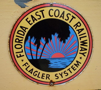
There are a number of DeFever Cruisers members here in the harbor and living in the area, so I put out a call for an impromptu luncheon that brought all 19 local members out!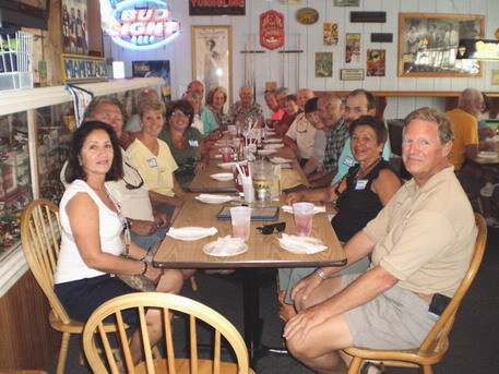 We’ve been riding our bikes a lot, including taking a bike tour of Pigeon Key – a small island about two miles out the old Seven Mile Bridge where work crews lived while building the famous Overseas Railroad, sponsored by Henry Flagler (sometimes known as “Flagler’s Folly”). We visited Pigeon Key on the 99th anniversary of the train coming down to Key West, which was really neat.
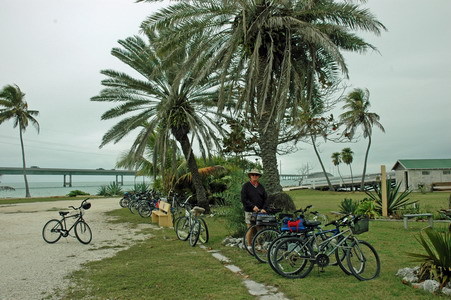
 In between the fun stuff we’ve been catching up on small repairs, oil and fuel filter changes, and projects. We’re doing a big clean-out throughout the boat since we’ve accumulated too much “stuff” after 6 years of living aboard. No photos of the mess while the projects are in progress!
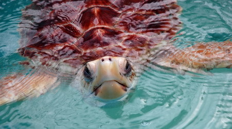
We paused from our chores to take a tour of the famous Turtle Hospital where sick or injured sea turtles are treated and hopefully released back into the wild. Some have injuries too severe to live independently so they are permanent residents. The entire operation is quite impressive for a non-profit organization, and they are doing wonderful work!
 We attended a neat lecture on the history of weather forecasting in the Keys (since the 1800’s) down in Key West, we’ve gone to see the local community theater, and have been meeting friends for lunch now and then. It has been a very social season!
Sunsets are always a time to pause and appreciate the day – you can’t beat the view from our dock.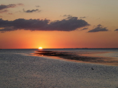 A white heron has been hanging around the dock quite a bit lately, as well as this particular green heron sitting on our dock lines.
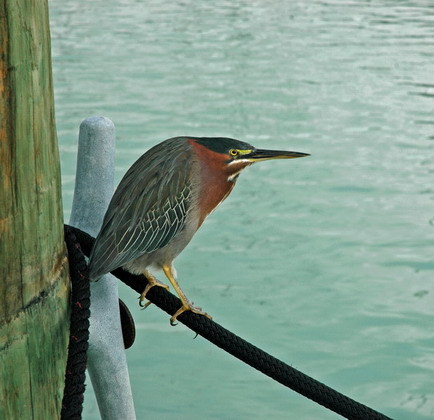 Jim continues to be busy in the engine room, and I’ve been busy re-varnishing some areas in the pilothouse and in our head. It’s a balance with the fun stuff, and it’s all good.
March 1, 2011 – I’ve had the Blog going for just a few years and it’s humbling to see that we’ve had over 50K hits so far. I apologize for not blogging more often this winter but we’ve been focused on our projects and haven’t had much free time. We’re about to cast off the lines and start moving again, so there will be much more to Blog about.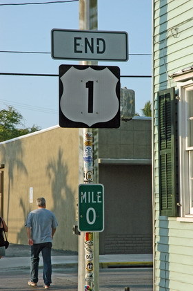 Yes, the end of the line… end of our time here in Marathon. This is the signpost down in Key West for the end of Route 1, down where everything is the “southermost”. We went down to KW with friends for a little exploring, and we paused to see some of the well-established crazies on Mallory Pier for the daily sunset party. Here’s the Southernmost Bagpiper. Only in the Keys…
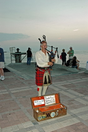 About 10 days ago I headed down to Big Pine Key for the monthly Sunset-Moonrise Kayak trip to benefit the National Wildlife Refuge volunteers. It was an absolutely perfect evening to be out on the water – watching the birds and looking out for Key Deer while we waited for the sun to set. We enjoy sunsets every evening, but this one was capped by the rise of the full moon over No Name Key. Fabulous.
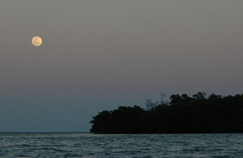 The next day we headed up to Miami for a day at the Miami Boat Show. We volunteered in the Seven Seas Cruising Association booth for a bit, then met our friends the Berrys and the Russells to see the miles of booths in the Convention Center and talk to the vendors.
A few days later Jim celebrated his birthday. I don’t think he cares a lot about birthdays, but he’s always happy to have dessert!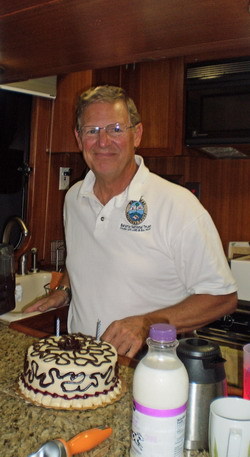 Chocolate-raspberry cake, chocolate chip ice cream, and friends – what could be better? Happy Birthday Sweetie!
 We went out with Richard & Carol to do some diving out by Sombrero Light but the conditions were not very good – rough waves, bad visibility, and a lot of portuguese man-of-war. It was a great day anyway.
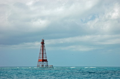 I continue to kayak as much as I can, looking for underwater critters and birds. This is a young ibis – they turn white when they become adults.
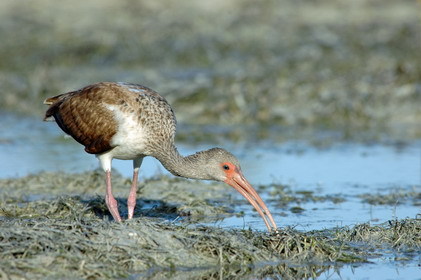 It has been a delightful winter season, with DeFever get-togethers and friends on the dock. We’re always sad to leave, but excited for new adventures.
March 27, 2011 – We enjoyed our last Marathon sunset over the Seven Mile Bridge and started making our way up the SW coast of Florida, heading to the DeFever Rendezvous in Sarasota.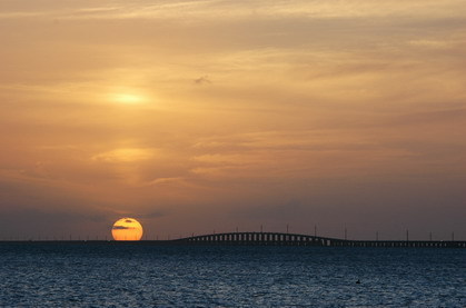 Here’s a map to show some of the area we covered. We anchored near Everglades City in the upper corner of the Everglades National Park, in the area known as the Ten Thousand Islands (there are actually about 40,000). From there we headed up past Marco Island, Naples, and Ft. Myers to Sanibel Island and Cayo Costa State Park.
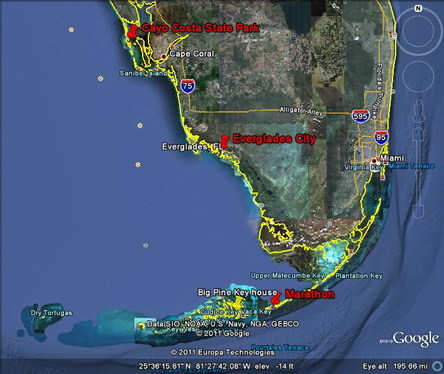 Out in the Gulf our friend Terry from Marathon buzzed us in his beautiful classic float plane – a real thrill!
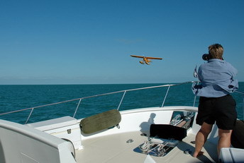 Before we left the Keys we did a photo shoot for him while he flew across the setting sun. He has a small collection of classic planes, and he flew this one down from Illinois for the winter.
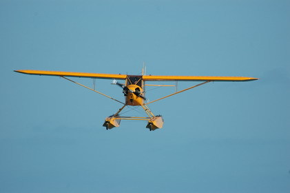 We anchored in the NW corner of Everglades National Park, among the rabbit’s warren of mangrove and wooded islands near Everglades City – it felt very remote and wild. We took the dinghy a few miles to the tiny town (“city” is a misnomer) to have lunch at the famous Rod & Gun Club.
 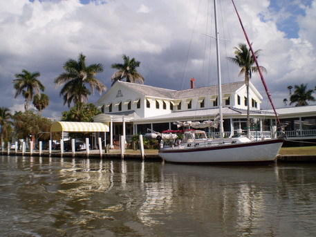 It’s an interesting old place but it seems a bit past its prime.
  The setting on the porch was lovely for lunch but the food was marginal, ridiculously expensive, and the wait staff barely spoke to us.
 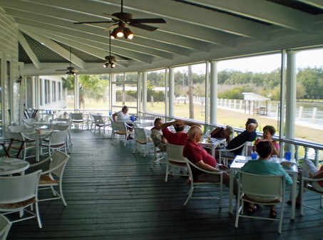 The little museum in town was great though, and we only wished we had more time to explore the endless natural beauty in the wild areas… but the weather was changing and we had to go while we had a good weather window.
We just got our anchor down near Sanibel Island when this storm hit – we only had 30 knots of wind but the Keys saw 55+ knots! The winds were predicted to kick up a bit so we moved up to nearby Cayo Costa State Park – there’s a great protected anchorage in there that’s tricky to enter, but worth the trouble. 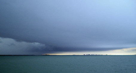 April 3, 2011 – Cayo Costa State Park. We found excellent protection from the strong winds by tucking into Pelican Harbor next to Cayo Costa State Park – just a bit north of Ft. Myers, FL. We spent a few days wrapping up some projects on the boat while the wind howled, and when it settled down and we could relax a bit I was able to get out for some long paddles in my kayak. The island is right next to an inlet to the Gulf so the water is clear and the fish and birds are plentiful.
 There were a number of nesting ospreys around, and I was able to get fairly close to them. In this second photo I watched the osprey flying with this fish – it was longer than the bird!
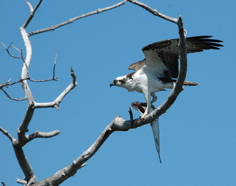
If you spend time around the water you may see cormorants – dark birds that dive under the water to fish. This is an anhinga – a larger cousin with a longer, snake-like neck and a longer tail. 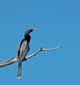 There were plenty of kingfishers, cormorants, gulls, terns, herons, and ibis around. The shells were also plentiful – lots of large horse conch and tulip shells which were easy to see in the clear water. Most were occupied, but I did find one good-sized tulip shell that was empty, which I kept. It’s such a gorgeous area yet relatively close to Ft. Myers and Punta Gorda.
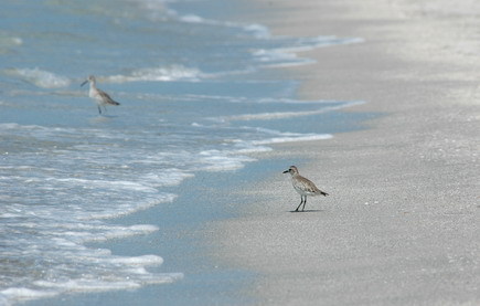 On the Gulf side of the park there’s a beautiful beach with lots of wading birds feeding in the surfline like this sanderling and willet.
Aside from kayaking and exploring the island a bit, we also helped rescue a sailboat that was hard aground. It’s a tricky and narrow channel to get into the anchorage, and they didn’t have good charts. They had been stuck for about two days, despite two visits from TowBoat/US. We had just wrapped up our projects and launched the dinghy, and Jim had some ideas for getting them free – and the tide was high. It took about 45 minutes, one other volunteer couple, heeling the boat a bit, Jim standing on the anchor chain, and lots of pushing and rocking with our dinghy but we did get them free before sunset. It was a good way to end the day.
April 4, 2011 – Sarasota and the DeFever Rendezvous. Our main reason for heading up the west coast of FL was to attend the DeFever Rendezvous in Sarasota. From Cayo Costa it was an easy two day run and we arrived a few days early to get the boat cleaned up and to spend time with our good friend Heidi.
This map shows the territory we’ve covered since leaving Marathon, with stops where the big green pins are.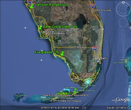 It was my first time in Sarasota – quite a contrast with the nature and quiet we had at Cayo Costa. The Rendezvous was held at Marina Jack, next to the city’s Bayfront Park. It’s a lovely area – very clean and nicely landscaped. We had perfect weather, which never happens for DeFever Rendezvous. Historically we have at least one major violent storm rip through every Rendezvous, but luck was on our side!
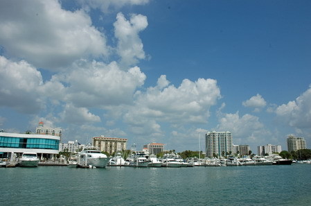 The area is a bit pish-posh, and there were plenty of big yachts that made our biggest DeFever boats look small.
The town has lots of lovely sidewalk cafes and restaurants, book shops, antiques, and many other attractions. Ringling of the famous circus built an opera house here, and there is a lot of live music and other arts. I tend to prefer nature to a city, but Sarasota is very nice.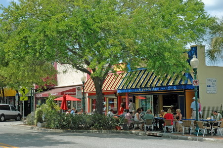 Walking around the north side of the marina I came upon this huge statue recreating the famous “V-J Day kiss” photograph from LIFE Magazine in 1945.
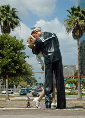 You have to love a place that builds giant statues of happy things like kissing!
The Rendezvous – a gathering of people who own or love DeFever boats – was attended by about 130 people and 25 boats. We had a big dock-tail party, two mornings of seminars given by members, a Hawaiian themed party, silent auction (we got a great deal on a week at a marina in Jupiter, FL where good friends live), and boat visitiations so we could meet people and exchange ideas. It was a marvelous event and everyone had a great time.
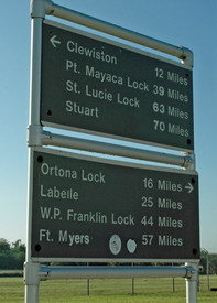
Rendezvous are hectic and exhausting – so many people, too little time. It was all over too quickly and we had to head south towards Ft. Myers to take the Okeechobee Waterway across the state of Florida – a short-cut to the east coast. With the drought conditions the Lake level was getting dangerously low, and we needed to get across while we still could. The alternative would be to go back to the Keys and up the other side of the state – a much longer trip. The Okeechobee Waterway will be the topic for the next blog entry – stay tuned.
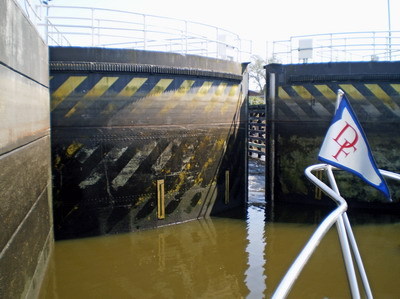
April 5, 2011 – Okeechobee Waterway. The Okeechobee Waterway cuts across Florida, connecting the Caloosahatchee River and a dredged canal (west side) to the massive Lake Okeechobee (451,000 acres) in the middle, then to the St. Lucie canal and river. It’s a 154 mile long short-cut through the middle of nowhere. It was our first time across and it was very interesting! Follow the green line on the map…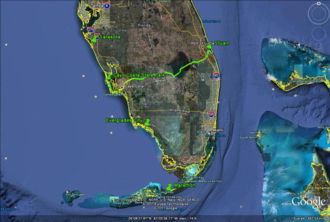 The waterway belongs to the Army Corps of Engineers to control water for floods and hurricanes as well as for irrigation in south FL. There are 5 locks and a number of bridges.
  Along the Caloosahatchee there were small orange groves like this one – note the bee boxes.
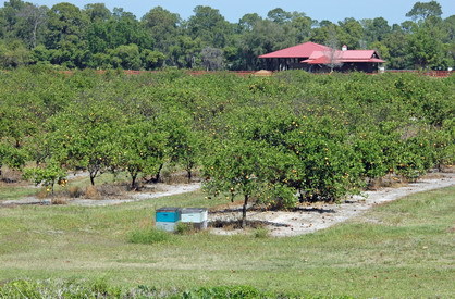 At our first lock we had 3 manatees, a small school of jacks, mackerel, and a HUGE tarpon (6′ long) that locked through with us. This is the lock right before the Lake – although the 3 locks that lifted us to the Lake level only raised us a few feet, this lock has tall gates to protect from hurricane flooding.
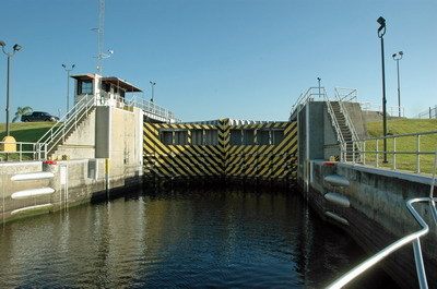
 The rim of the Lake had a spooky feel to it, with vast expanses of cypress and grass flats on one side, and tall levee walls on the shore side.
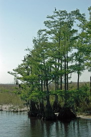 Of course we saw gators along the way… as well as lots of birds. The Lake was very shallow due to drought, and the worst part has a rock bottom. We had 1′ to spare under our keel in the shallowest spots… not fun!
 The St. Lucie lock dropped us 12′.
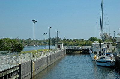
 And voila – after two and a half days of travel we’re in Stuart!
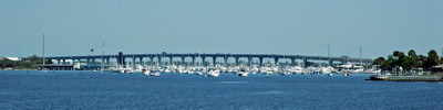 April 10, 2011 – Crossing Our Wake. We have come full-circle in a way, stopping in Stuart, FL. This is where we bought ADVENTURES more than 8 years ago, and it was fun to come back through the area where it all started.
  Stuart is the usual winter home for our buddy boat and cruising friends Chuck and Pat aboard GOT THE FEVER – another DeFever 49. We have been trying to cruise with them for years, and this year things finally worked out!
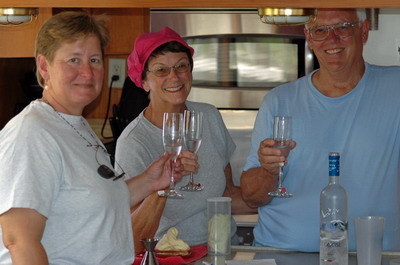 I confess that I’m an early riser and I just couldn’t resist running around the dock in my pajamas to photograph the beautiful pre-dawn sky… but I wasn’t the only one up – I surprised some fishermen cast-netting for bait. Good thing I have decent jammies.
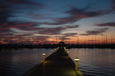 When we pause anywhere we tend to dive into projects, chores, and repairs. This is a photo of Chuck helping Jim replace the motor mounts on our 15kw generator. It took about 3-4 hours and the result is a MUCH quieter gen! (THANKS Chuck!!)
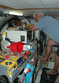 Pat and I headed to the stores to do some major provisioning for our big trip to Nova Scotia. Yes, there are plenty of stores in Canada and along the way, but it’s nice not to have to stop and find a store if we don’t have to. We made endless trips down the long dock, hauling carts full of groceries and supplies. Remember, we came from the Keys where we don’t have many “big box” stores. It’s a treat to go to Target, Wal-Mart, Bed-Bath-Beyond, etc. Once every few months is plenty for me. Of course loading all the provisions aboard means reorganizing the storage areas a bit, and updating the inventory – “counting the cans” is an all-day job.
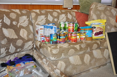 We got to know some of Chuck and Pat’s friends in the marina, and were very impressed with a ship captain from Newfoundland. He’s encouraging us to venture up there from Nova Scotia, but it’s a lot of miles. We’re inspired though, and will probably take the ferry over and do some exploring. There’s another couple from our DeFever club who live up there and it would be fun to visit them too. It was a frenzied week of activity, but we accomplished a lot. Now it’s time to make some miles northwards!
June 26, 2011 – Long Island. Long Island continues to be a lovely surprise. We hated to leave Port Washington, with all its interesting aviation history – many large commercial seaplanes were manufactured there, and the Pan Am Clipper used to land there until Mayor LaGuardia convinced the airlines to move closer to NYC.
Our next stop was Huntington, NY where we found many small natural harbors and coves – moorings everywhere! I’ve never seen so many moored boats stuck in every nook and cranny. Huntington is another lovely town with tree-lined streets, beautiful stone walls, and lovely gardens. It boasts a nice little art museum (which happened to have an Edward Weston exhibit) and a gorgeous wooded park with ponds. We found an ice cream and fancy cake shop that looked interesting, so we all had to give it a try.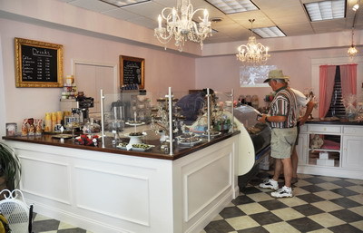 I think we were most intrigued by the nifty ice cream cone “flower arrangement” in the window… and the ice cream proved worthy of the fancy decor.
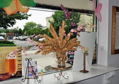 Along the shoreline we’ve seen homes that range from enormous mansions to just regular houses, but the setting is hilly and wooded and beautiful.
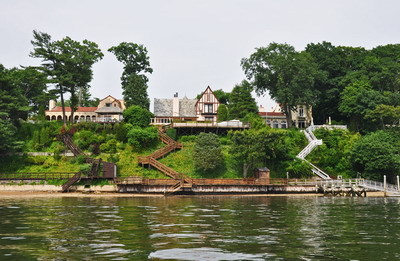 From Huntington we headed out to the “fish tail” on the eastern end of Long Island. We anchored in Coecles (pronounced “cockles”) Harbor in Shelter Island – very pretty and quiet with a large protected bird sanctuary on the south shore. Coecles was a good protected place to anchor and the water was very clean and clear. I kayaked around the sanctuary and saw lots of terns, gulls, ospreys, and raccoons hunting in the shallows.
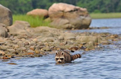 We dinghied over to famous Sag Harbor to get a feel for part of the fancy-schmanzy “Hamptons”, and enjoyed walking the town. There were lots of bigger yachts, but it’s still a little early in the season and mid-week.so I can imagine that the “bling factor” goes up quite a bit once summer is in full swing.
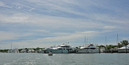 Sag Harbor has a nice little whaling museum, lovely tree-lined streets with old homes and pretty flower gardens. There are interesting shops ranging from trendy to artsy, plus a good old-fashioned hardware store (packed to the gills with a bit of everything) and a little IGA grocery. And of course, ice cream shops.
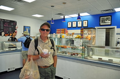 July 1, 2011 – Block Island and Buzzard’s Bay. Here’s a map to show you where we are at this point, with the eastern end of Long Island in the lower left corner and Cape Cod on the upper right.
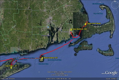 We made a short overnight stop at Block Island – the last time I was there by boat was in my Sea Scout (Ship 97) days 34 years ago. I remembered how thrilled I was to be there back then – a good reminder that dreams do come true since it was my wildest dream to someday go back there on my own boat.
We happened to arrive during Block Island Race Week which was pretty neat. We entered the Great Salt Pond just as hordes of racing sailboats were heading out.
Block is a little more built-up since my last visit but there are plenty of wild places and fresh water ponds and hills and beach to enjoy. I got to go back to The Oar restaurant where I remember eating 34 years ago. The Oar has hundreds of oars that people have painted or decorated or engraved, hanging on the walls and covering the ceiling. Somewhere is the one the Sea Scouts put up, but we couldn’t find it. We’ll have to go back and look some more another time. We had some swans visit us while we had lunch out on our mooring, and we thought it was neat to see one of the little cygnets getting a piggyback ride.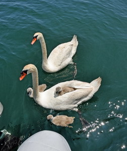 Our visit was too short but the weather was changing so we had to move on. We had decent weather to head into Buzzard’s Bay and we cruised into New Bedford, MA on a cool, drizzly afternoon. New Bedford claims to be the largest commercial fishing port on the eastern US coast and I can believe it!
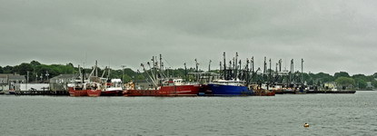 There is a massive hurricane barrier across the outer harbor with big gates that can be closed in extreme storm conditions.
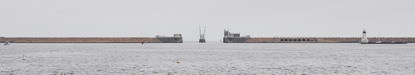 I can’t even estimate the number of large (100′ or bigger) commercial fishing boats in the harbor. GOT THE FEVER (our buddy boat) and ADVENTURES stopped at a commercial fuel dock to fill up, tucked way back behind barges, tugs, and packs of rafted commercial scallop draggers. The guys on the fuel dock couldn’t have been nicer to us and they really made us feel welcome. After a long day cruising from Block and getting fuel, we were all too tired to go ashore. It’s a big city and although there are dinghy docks in various spots that are convenient to things that cruisers might want or need (stores, restaurants, and the whaling museum), it’s a bit intimidating to be in such a commercial, bustling place.
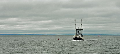 July 5, 2011 – Cape Cod and Provincetown. Provincetown is a great place to stop – it’s the very tip of Cape Cod and is home to a National Seashore as well as an active fishing fleet, artist colony, and lively gay community.
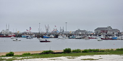 It’s a wonderful little town and we really enjoyed it. Of course the highlight for us was getting to spend time with our friend Heidi, who grew up on the Cape. Heidi came out on the launch with some fresh local Portuguese bread and we used the sweet soft bread to make french toast. Along with some bacon and fruit salad it was perfect for a damp, chilly New England morning. There is a big Portuguese population and history in this fishing town and around the region.
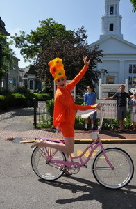 There are some incredibly talented people in this town – we were very impressed. Heidi showed us all around town, and we poked around galleries, shops, and the neighborhoods to see the pretty New England homes and cottages, and to see some of the places that were special to her when she was growing up. We met Chuck and Pat’s artist friend with a gallery here and we fell in love with her paintings! We enjoyed the people-watching and some of outrageous outfits people wore. I wish we could have seen this guy’s show “Lipschtick” – he was very talented.
We were lucky enough to be here for the annual Portuguese Festival, celebrating the long history of people from Portugal and the Azores who came here in the 1800s to fish. The Festival parade was terrific, with dancers and bands from various Portuguese clubs around Massachusetts and New England.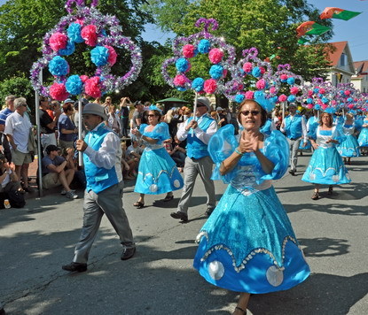 Heidi took us to the see part of the Cape Cod National Seashore, with whales blowing and beautiful natural dunes and shore birds and lovely beaches and beech and evergreen forests.
 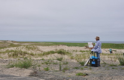 You have to admire the New Englanders – they were swimming off the beach in this cold water! The Cape is a wild and gorgeous place and I can easily see why people love it so. We managed to pack a ton of wonderful sightseeing in two days and we had tons of laughs. We will definitely be back to explore the Cape much more!
This is the view of the harbor from the top of the 252′ monument to the Pilgrims.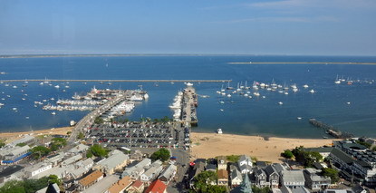 And the monument… a long climb but worth it for the views!
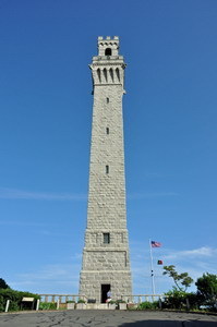 July 6, 2011 – Stellwagen Bank, Gloucester, and Maine. On the cruise from Cape Cod to Gloucester, MA and then up to Casco Bay, ME we spotted a pilot whale, blow from a larger whale, seals, tiny Wilson’s storm petrels…
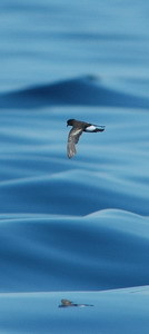 …and shearwaters (this one is a yearling).
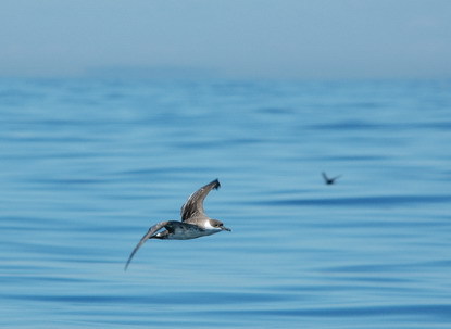 We were trying to make some miles so we decided to just stop in Gloucester for a quick overnight – we’ll tour it on the way south in the fall. It’s such a pretty spot, even just viewed from the water.
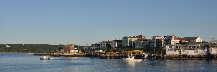 Now we’re starting to see eider ducks – they are funny looking with a ramp-like beak.
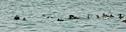 We ran a long day from Gloucester all the way to Casco Bay, Maine. We were thinking of going into Freeport to visit the famous L.L. Bean flagship store, but the weather was going to change and we wanted to get to Rockland where there were more services and places to see. We anchored in Potts Harbor for the night – mostly a fishing village with lots of lobster pots (we always laugh at the ironic name), but it had been a long day’s run and we had more miles to go the next day.
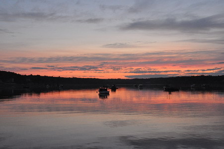 The next day we made it to the mouth of Penobscot Bay – the town of Rockland (which we privately refer to as “rockin’ Rockland” because there is no speed limit and the lobstermen come roaring in and out of the harbor with big ugly wakes).
 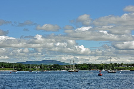 It was a beautiful day when we arrived, but the weather was changing and we were glad to be tucked into a good harbor with some interesting things to do while we waited for the weather to improve. The next day was predicted to be rainy and ugly so we rented a car with Chuck and Pat and drove over to Freeport – home of L.L. Bean. We had a ball investigating the outlet store, then the main store and other shops in the area. It was a good way to spend an ugly weather day, and it was neat to watch the fog roll in and out.
In Rockland we saw lots of guillemots (a sea bird who is a cousin to the puffin)… and an osprey who hunted regularly in the boat basin behind the Coast Guard Station.