Pop Quiz: What’s the Fourth-largest island in the U.S.? (Hint: numbers 1, 2 and 3 are: Hawaii, Kodiak and Puerto Rico). 135 miles long by 45 miles wide, located near Ketchikan, Prince of Wales (or “POW” as it’s known locally) is an intriguing place to explore.
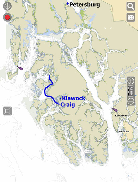
The blue line shows a small part of our wiggling route from the small islands and passes of Sea Otter Sound and the lower end of El Capitan Passage to the sister towns of Klawock and Craig. The island has some unique geology including karst (limestone) and caves at the north end. A marble mine is still active today, and gold, silver, and even uranium has been mined on the island in the past. These days it’s known more for timber and fish, though the amount of logging is less than it used to be. Thanks to all the logging there are about 300 miles of roads on the island, though there are only a handful of communities – the population of the entire island only very slightly bigger than Petersburg. About 8 or 9 of the communities have seaplane docks, but there is only one airport – in Klawock, and it only serves small aircraft. If you want a commercial jet you have to hop to Ketchikan or Sitka.
After weeks out in the wild places it’s fun to stop in a town… Stores! Restaurants! Internet! Phone service! Our first stop was Klawock which is a Tlingit town.
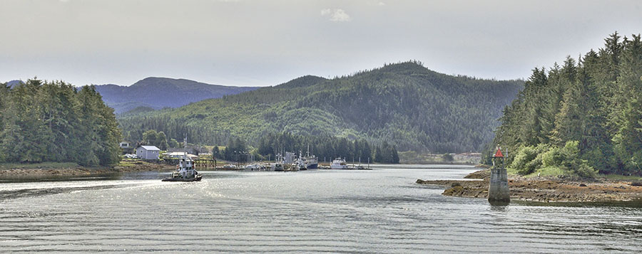
Klawock has a very small harbor but the accommodating harbormaster found about 35′ of dock space for our 50′ boat – no problem.
Besides having the only airport on the island, Klawock is known for its totem park. At one point it was a resting place for abandoned poles from all around the area, but those poles deteriorated enough that they had to be retired. New poles were carved and they’re arranged on the hillside overlooking the harbor.
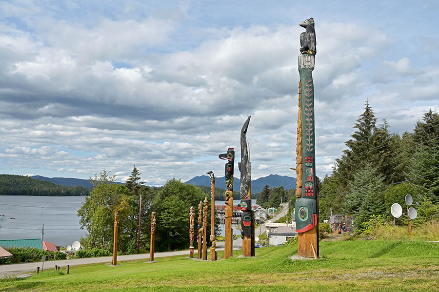
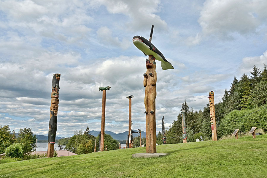
Unfortunately they didn’t have any placards to give information about the various poles – I’d really like to know the story about the orca on the bear’s head, as well as this neat interpretation of a raven wearing a black jacket.
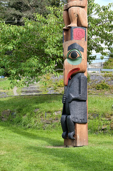
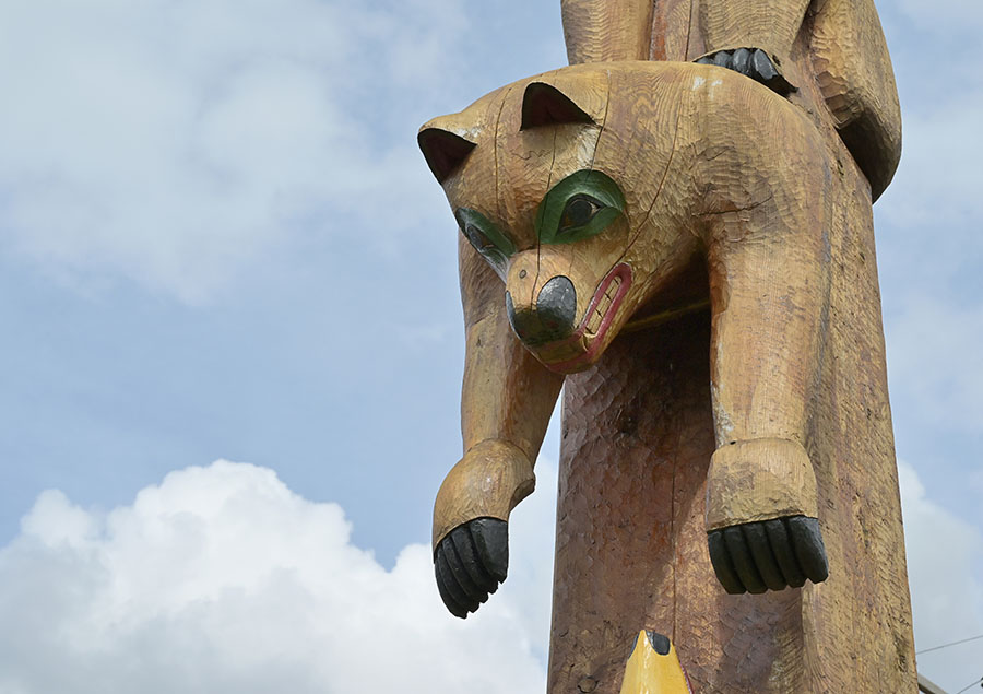
We had a ball looking at all the details on these poles, and were glad to have a day of sunshine to do so. The next day we were so excited about walking to the grocery store, post office and cafe – all located together about 2 miles away – which would be a lovely walk except for the pouring rain. Rain covers for our knapsacks and rain gear for us – no problem, and well worth it for a nice lunch and fresh veggies.
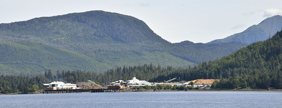
The weather forecast showed some significant winds heading our way so we called the harbormaster in the bigger town of Craig and got a more secure spot to sit out the weather. Besides, Craig has more restaurants! As we headed out of Klawock we saw a ship being filled with logs and other wood products…
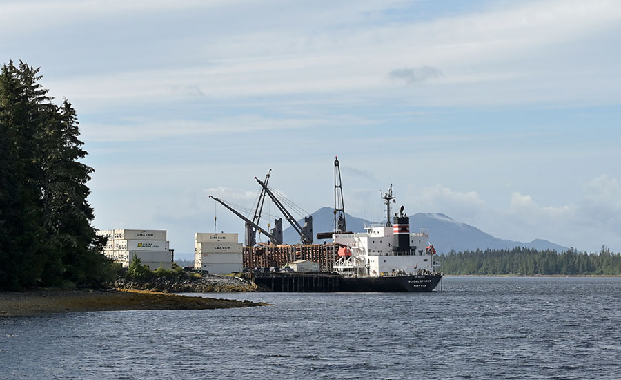
…and we passed by the sawmill just to the south of the ship terminal.
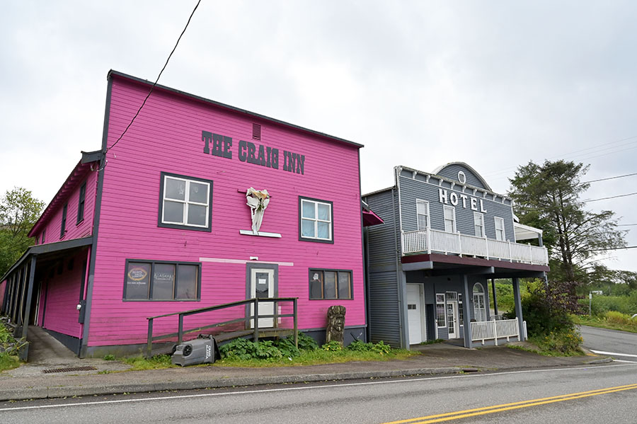
Approaching nearby Craig we couldn’t miss this distinctive pink bar, even from more than a mile away.
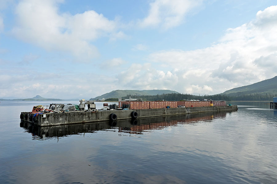
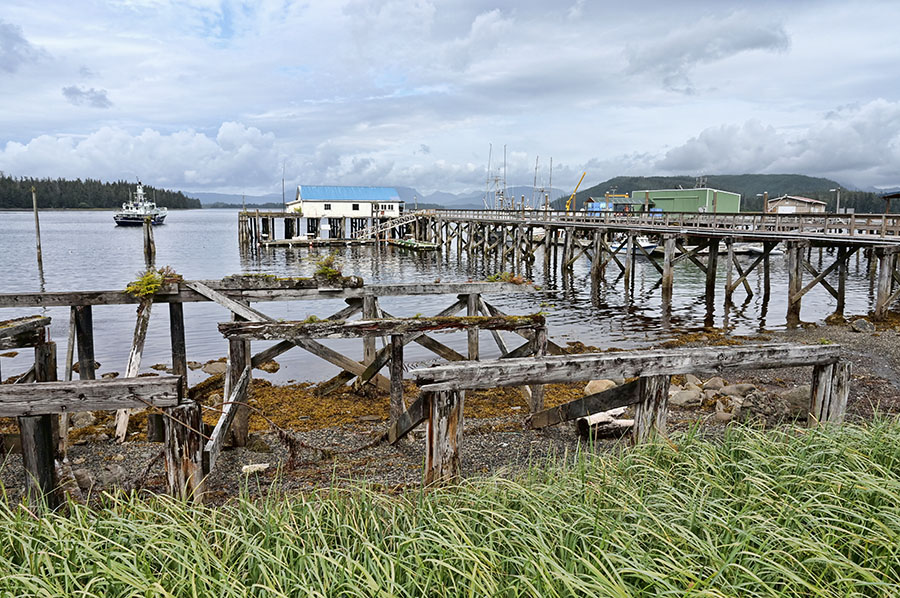
Craig’s north harbor is protected by a very practical breakwater – a big barge with shipping containers on it that are used to store commercial fishing gear. It works well!
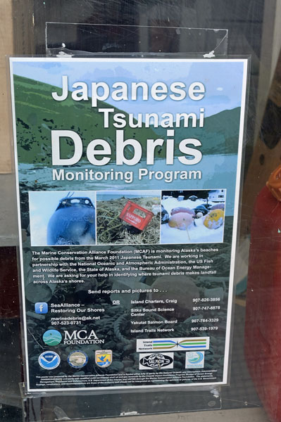
If you look at the map above you can see that Craig is somewhat protected from the open ocean by small islands, but a tsunami is still a risk…
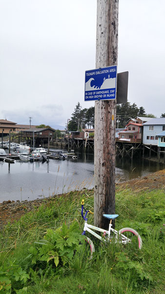
…and this sign in the window of the cannery museum is a reminder of how much world events can come ashore right here at home.
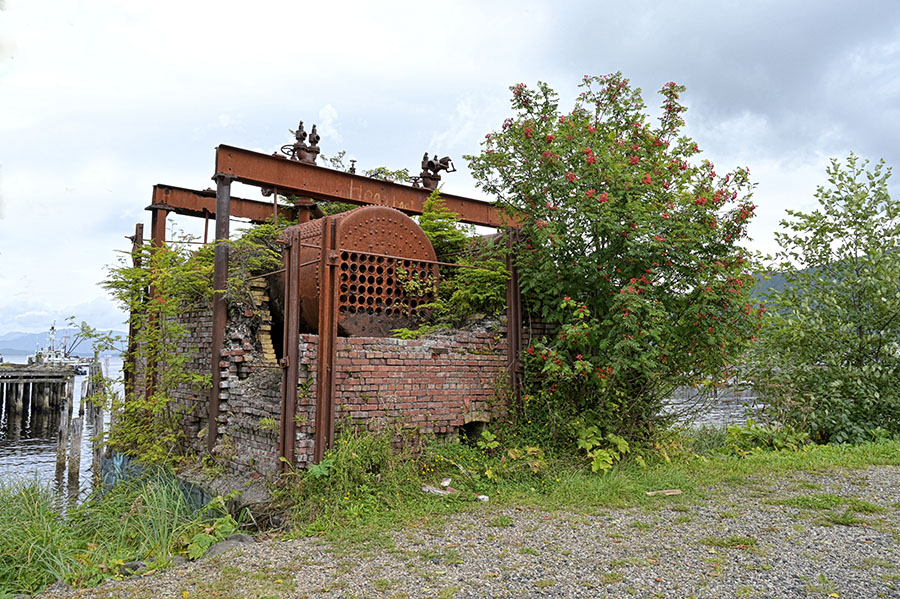
The old cannery on the outer bay has been abandoned…
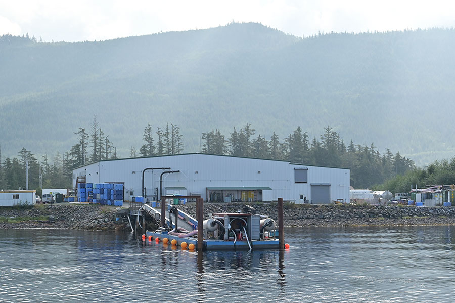
…but there’s a newer fish processing plant in a more protected spot. These two devices are giant fish vacuums – they slurp the salmon out of the fish holds.
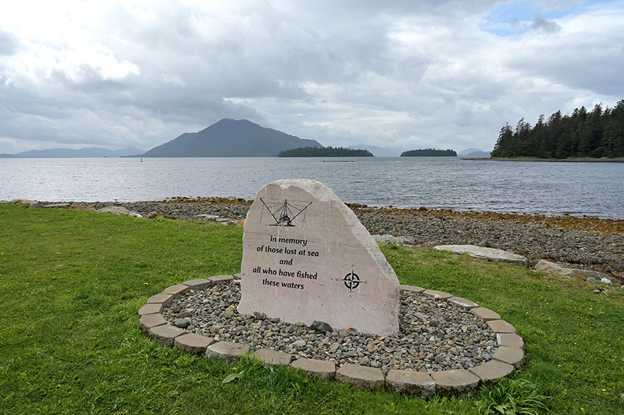
We can never forget that commercial fishing is a dangerous way to make a living and to provide us with food.
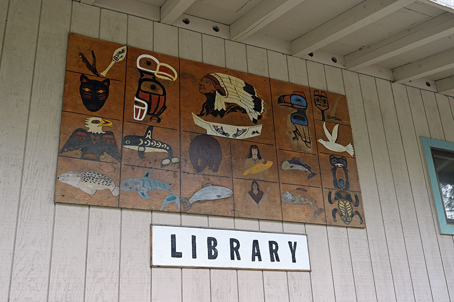
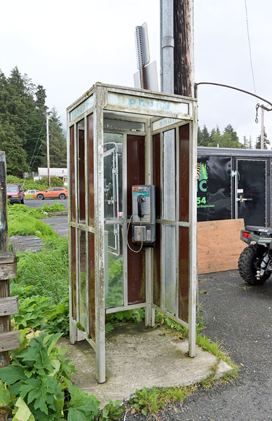
We ate lunch out every day, sampling a few different places and spending time in the Library where we could get some Internet. Just in case though, there’s still one of these things in town!
The gale abated, the fishing fleet left, and we topped off groceries and water before heading back out to the quiet places.