Leaving Pelican, we were once again exploring new territory – something I particularly like for the challenge and the unexpected. Here’s our path southwards from Pelican down to Portlock Harbor on Chichagof Island.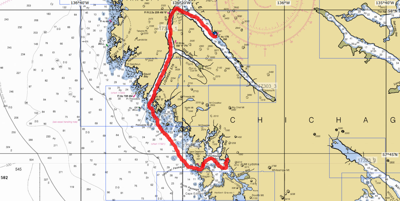 Even though we were cruising the ocean or “outside” coast of these big islands, there are a number of routes and passages that offer some protection from the ocean swells. One such passage requires winding through rocks – which looks pretty daunting on the chart!
 The blue areas are shallow water and all those little asterisks and dots are rocks, yet this is a good passage used by fishing boats all the time. The worst part was at the beginning when we had to pass very very close to a rocky island, but the depth sounder confirmed that we had plenty of deep water. Watching the waves breaking on the outer rocks made us glad for the protection of this wiggly passage, and I felt much better about it when we passed a 91′ fishing tender. Part of the trip we were in the open ocean, and we’ve learned to stay out in deeper water where the waves are smaller. Our reward was a gorgeous anchorage that we had all to ourselves for a couple of days. And my first kayak exploration of the creek right in front of us revealed salmon and bears!
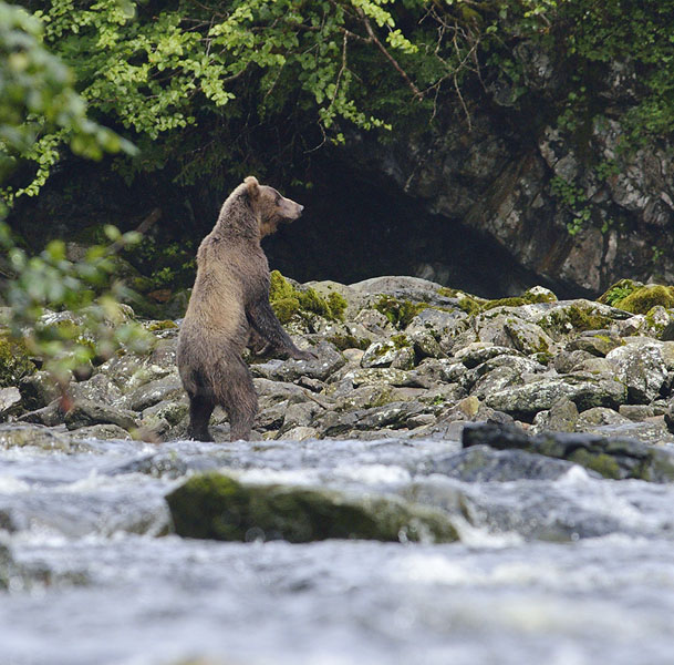
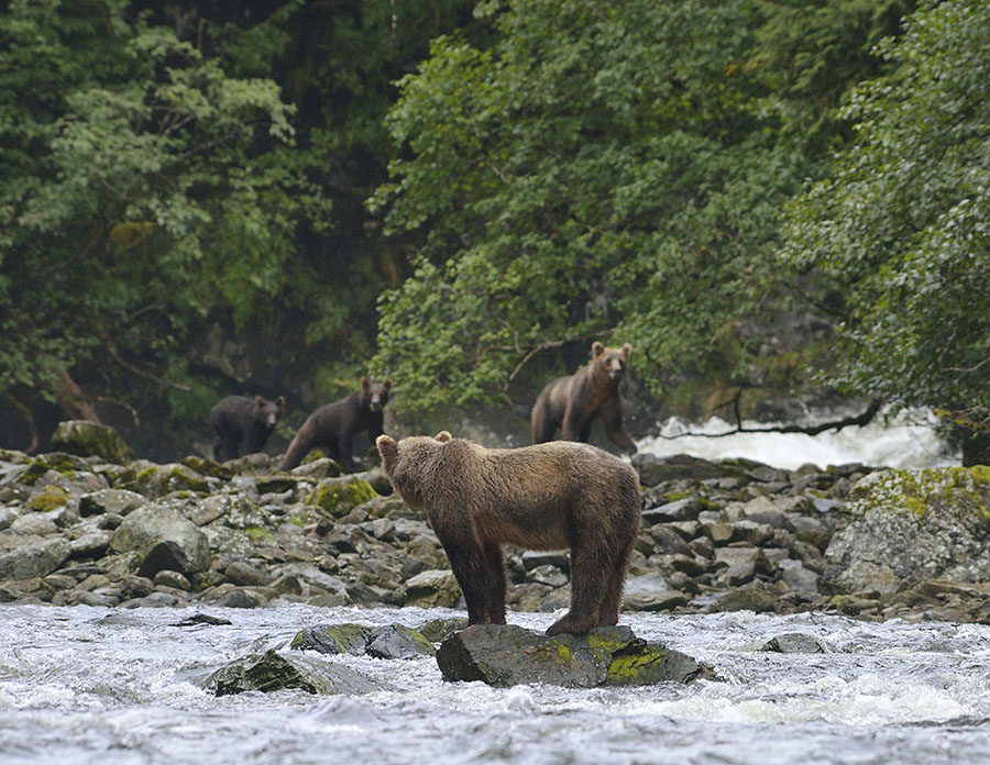 Bears have a definite pecking order, and they’re always looking around to check for other bears arriving. The sow and her two cubs in the background didn’t want to be around with the bear in the foreground, so they scampered back into the woods.
Our favorite was this bear that sat on a rock at low tide for ages, not really hunting for fish… just watching the world go by.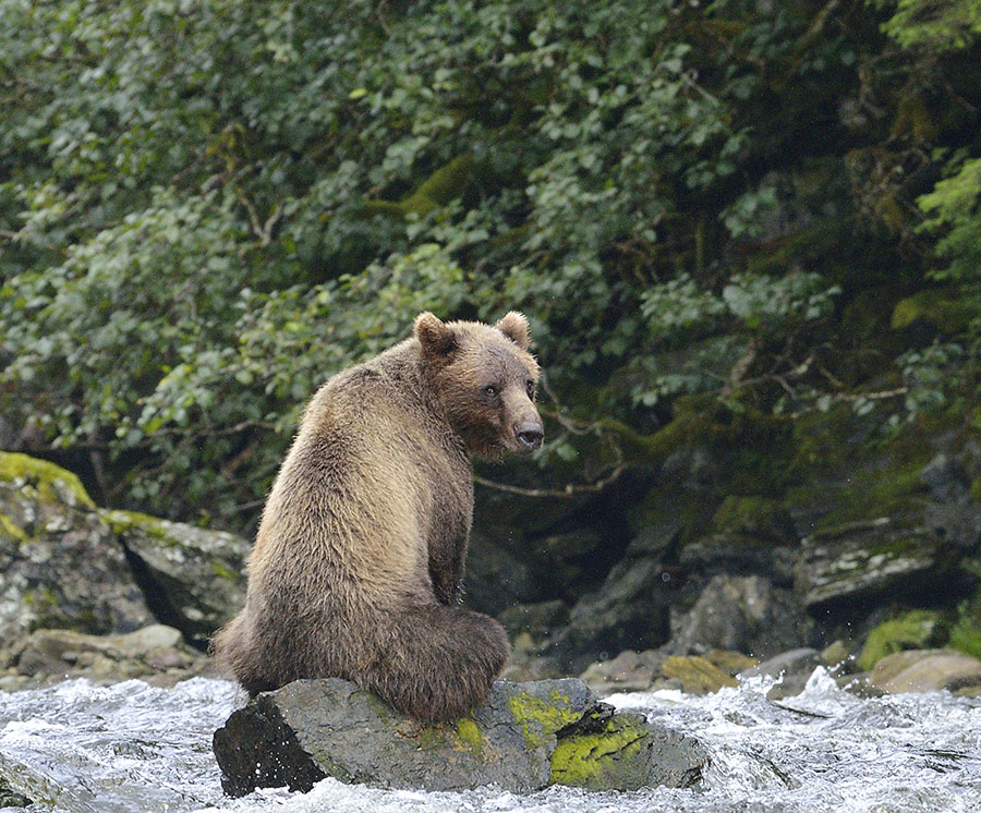
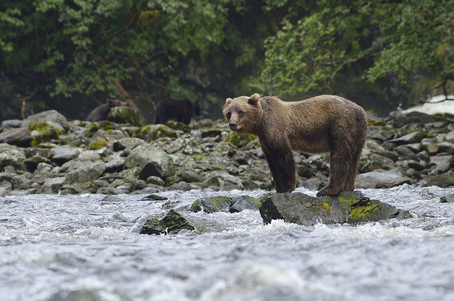 We’ve watched bears long enough to appreciate how expressive they are with their ears – amazing animals. But the weather was going to change and we had a good window to run further south down the coast.
 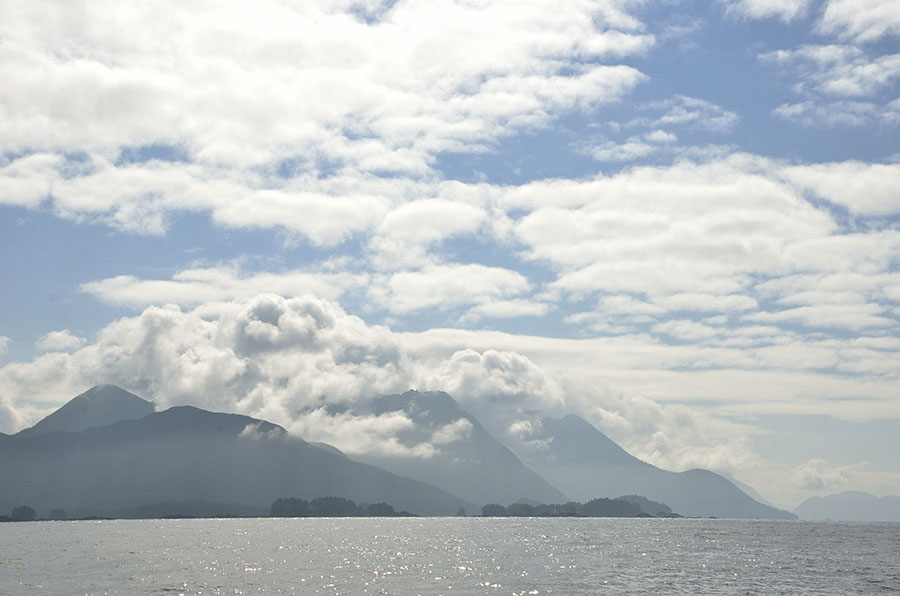 We decided to check out Kalinin Bay on Baranof Island, about 20 miles north of Sitka.
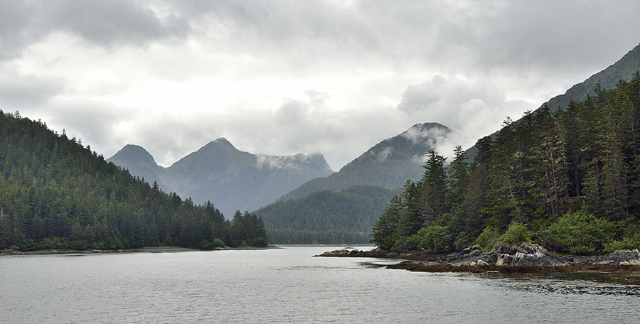 Kalinin Bay, like so many of the anchorages up here, is surrounded by beautiful mountains. It has a large estuary at the head, and at high tide I could paddle farther up the salmon stream and get even better views. There were many obvious signs of bear activity on the shoreline – not surprising since it was a good salmon stream. The fishing would be better for the bears at low tide, though I made sure to be noisy and watchful and carry bear spray.
 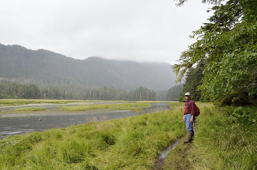 You can see part of the estuary here, since one of the reasons we came to Kalinin was to hike the trail over the ridge to Sea Lion Cove on the ocean side. The first section of the trail runs along the estuary and it was a muddy slog, walking next to bear nests and the flattened grass where the bears like to fish. What we didn’t realize was how steep the trail is – it’s 5 miles round trip, and we figure we hiked about 1500′ in ups and downs each way. The trail crews even created a nice staircase from huge logs…
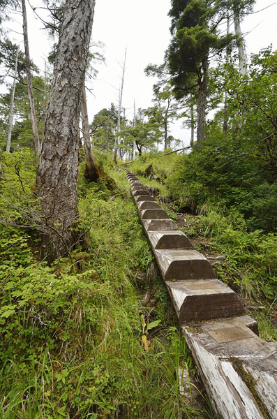 When you hike in bear country, you carry bear spray, stick together, and you make a lot of noise the whole time – bears will very happily avoid you if they know where you are. We were hoarse from saying “Hey Bear!!” for hours on end, but it’s worth the effort. Besides, we had a bear escort on the trail – there were rather fresh bear prints in the mud, going the same direction we were, for the entire length of the trail. That’s Jim’s big hand, for comparison.
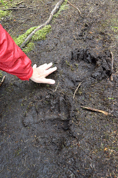 The view at Sea Lion Cove was dramatic – with hundreds of logs flung high up on the beach from vicious storms.
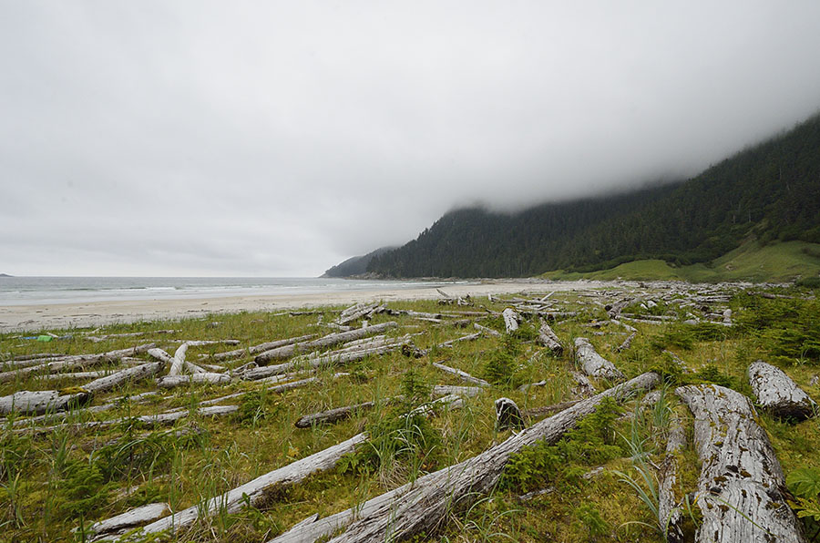 We’ve heard that the surfing can be good here, and that some people from Sitka will hide their surf boards in the woods. As we finished the hike we ran into two guys who were heading over the ridge to surf, dragging rather large surfboards with them – I can’t imagine making the difficult hike dragging a surfboard! Jim found this boogie board and thought about giving it a try… but he said he forgot his bathing suit. Maybe next time.
 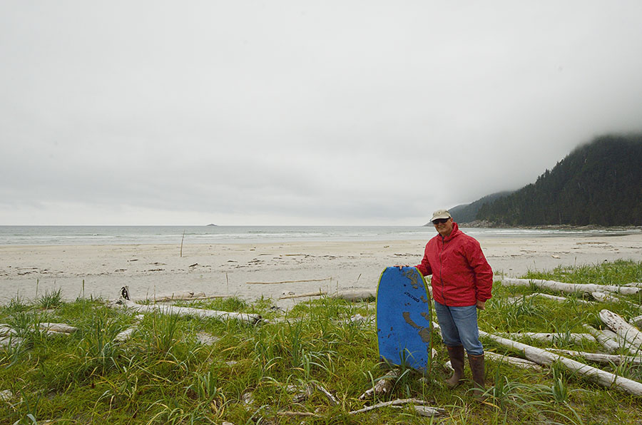 It was an interesting hike, but a hard one with all the vertical and then the muddy finish. I was so tired by the end that I managed to slip into two deep mud holes – thank goodness we took the kayaks ashore. I had to hose myself off on the swim platform – such a mess! We sat an extra day afterwards since the weather was nasty, and then it was time to catch up on some laundry and groceries in Sitka.
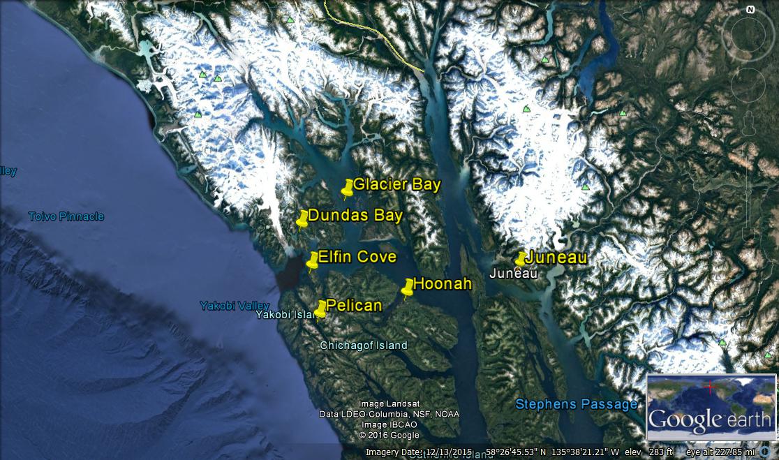 I included Hoonah and Juneau to help with some landmarks. You can see Glacier Bay where we enjoyed venturing far up the western arm (almost to the top of the map) and then we headed out towards the ocean to explore some new places.
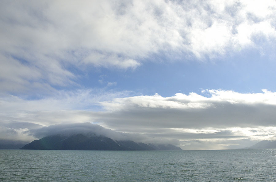 We’ve been wanting to go to Elfin Cove – a tiny boardwalk village tucked in a protected cove just off the ocean, but when we stuck our nose in there we found the dock jammed with fishing boats.
 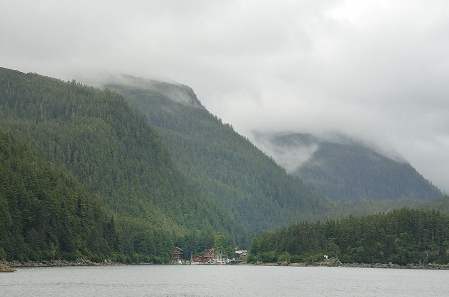 There’s no good spot to anchor there, so we had to retreat to an anchorage in the Inian Islands where we were pummeled with two days of rain. We were hoping to get a break in the weather so we could take a long dinghy ride to Elfin Cove and the Hobbit Hole, but there was no way – I couldn’t even kayak. We got tired of the foggy view so we jumped across North Inian Pass into Dundas Bay (on the map above) – part of Glacier Bay National Park that’s remote and doesn’t require a permit to enter. We had a brief respite from the rain cruising into Dundas, but by the time the anchor was set the drenching downpours started up for another two days. The weather broke and we were ready to get moving again, though we got a few treats first. The best surprise was an early morning sighting of a wolf.
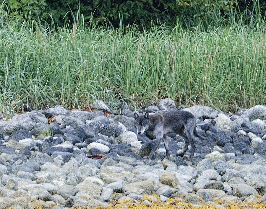 I saw motion out of the corner of my eye as I was scanning the shoreline for wildlife, and he was so camouflaged that I almost didn’t see him. He stayed in that band of gray rocks, blending in perfectly, and he just glanced in my direction once as he trotted along. Yowza! I’ve been wanting to see a wolf ever since we moved up here.
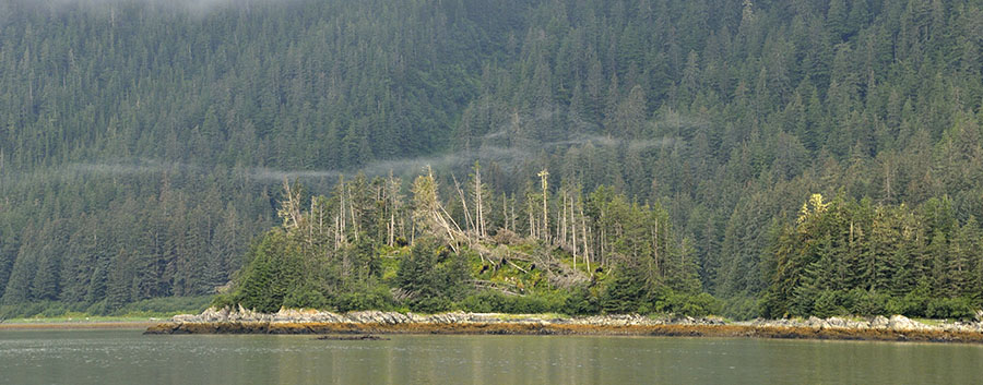 Notice anything odd? …such as the swath of trees that are knocked down? That’s known as a blow-down, and it’s caused by a blast of strong wind. There were a few other blow-downs in the bay, and it helps us imagine the fierce power of the fall and winter storms coming off the Gulf of Alaska. It’s a beautiful bay, worthy of more exploration.
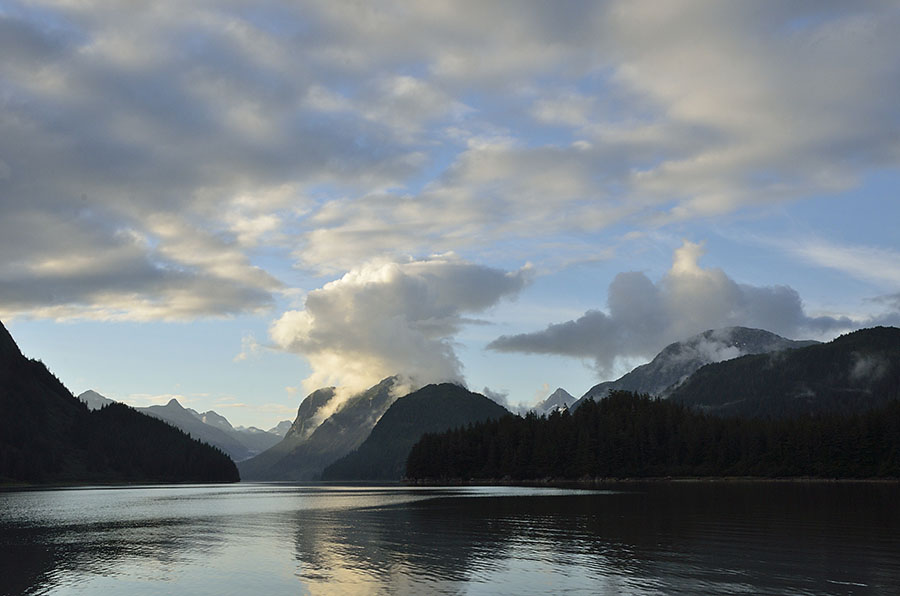 We headed back out towards the ocean to make another attempt to visit Elfin Cove, taking a rocky passage just inside the islands to shield us from most of the open ocean, choked with sea lions hunting when the water was turbulent at maximum tidal flow, but nice and calm when we transited near slack water.
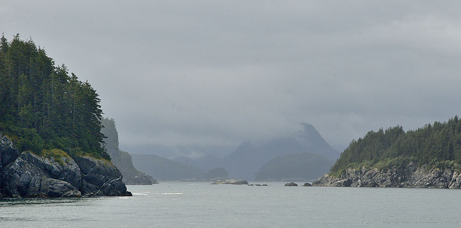 Once again, Elfin Cove’s dock was jammed with boats so we decided to run down the coast of Chichagof Island to Lisianski Inlet to check out the tiny town of Pelican. Along the way we saw lots of fishing boats, and we spotted one of the big 80-100′ tenders that buy fish from the trollers, re-supplying them with ice, fuel and supplies.
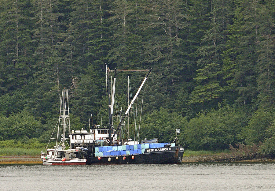
 The Alexander Archipelago is the name of the collection of islands and channels that make up the panhandle of Alaska – commonly referred to as southeast Alaska, or just “southeast”. If you look at a bigger map of southeast, you’ll notice that it resembles a shattered windshield – so even the area around the open ocean has many channels that offer some protection. But these channels are deep – 500-1000′ and sometimes deeper, surrounded by tall mountains. There are no roads to connect the settlements, accessible only by water or by air.
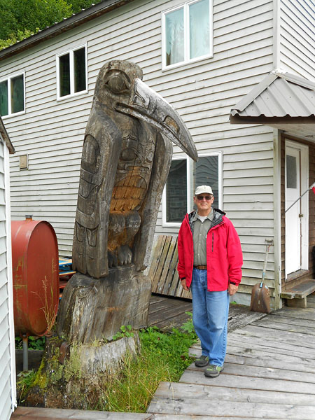
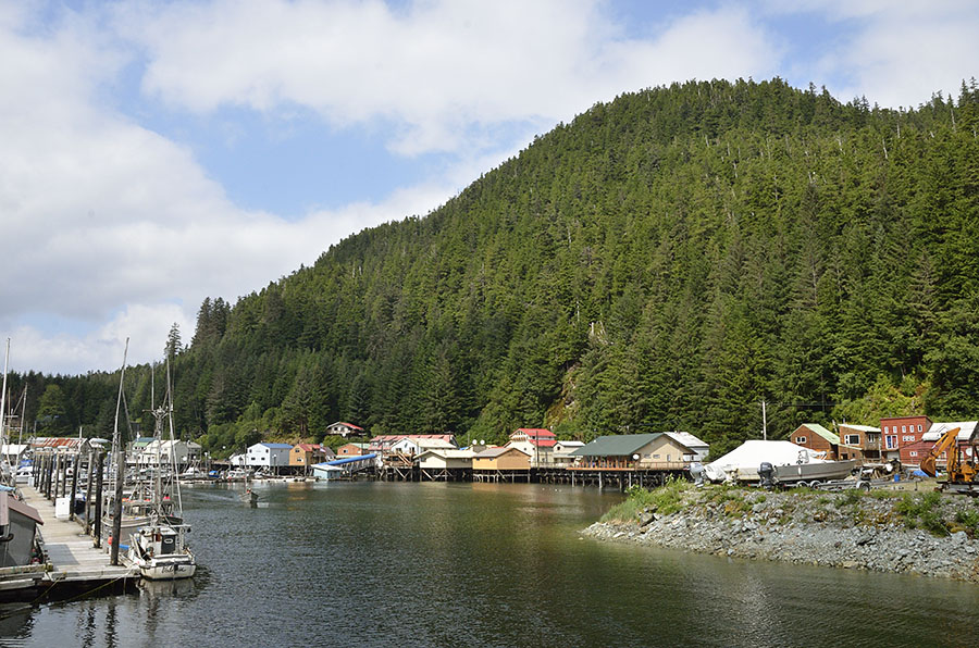 Perched against a mountain, most of the town is built on the edge of the land or over the water, and the main street is a boardwalk. People run around on ATVs and heavy duty golf carts.
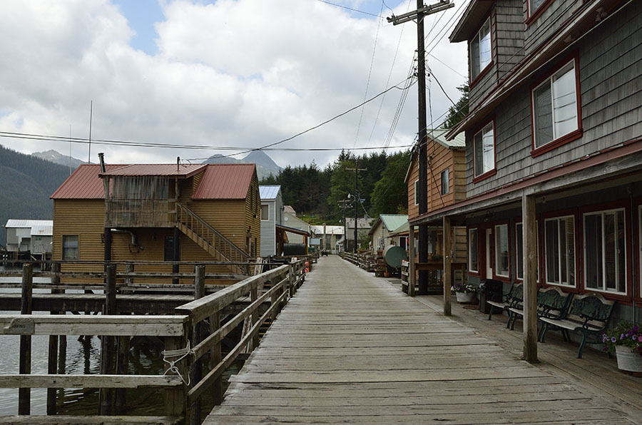 The big General Store closed when the cold storage was shut down, though some dry goods are available at the Inn where you can also get a mediocre pizza, or you can go next door to the famous Rose’s for a slightly more varied menu in a scruffy, smokey setting. It doesn’t sound like a great place, but the locals are very friendly, and it’s a beautiful spot. The people who live here don’t have it easy. Cuts to the State Ferry service mean that the summer ferry stops once every 5 weeks (less often in the winter), and the costs to ship things in by barge (like groceries) is about $1/lb.
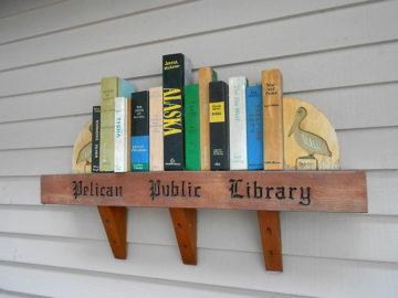 The Library was small but quite good, and I got to meet some of the local ladies at the weekly Sunday afternoon crafting session there. The town has a small medical clinic, but it was closed with a sign saying that the Physician’s Assistant from Sitka would be there for a day in later August. If you have an emergency or medical problem, you have to rely on volunteers and/or you take a float plane to Juneau (weather permitting). And for you fans of the radio show “Car Talk”, we found out where their lawyer’s headquarters are located – it’s here in Pelican!
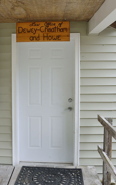 There’s no cell service in town, but you can hike up the mountain to the town dump if you want to make a call – except on Mondays, which are trash days. Trash is burned, and they burn it as soon as it’s collected to keep the bears from hanging around. Since the salmon were running the town was having some problems with bears on the boardwalk.