The Dalton Highway is a haul road – built to provide a way for big trucks to carry supplies and material from Fairbanks north to Prudhoe Bay on the shores of the Arctic Ocean. It typically takes two days to drive the 414 mile road, only 1/4 of which is paved. The only medical facilities are at the endpoints – in Fairbanks or Deadhorse/Prudhoe Bay. There is only one other place to buy fuel, at Coldfoot Camp about midway between. Traveling on this road is not for the faint of heart, and you need to be very well equipped and prepared.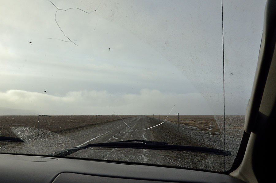 Notice the condition of the windshield – I took this photo out the front window of our tour van, and there were about 20 cracks or chips in it. Unlike many states, it’s not illegal to drive around with a cracked windshield in Alaska, otherwise people driving on these rough roads would spend more on tickets than on replacement glass.
We started our journey in Deadhorse, where Alaska DOT was raising and repairing the road after an unusual spring flood washed out a section, rendering it impassible for 18 days. Prudhoe Bay nearly ran out of food and fuel – an extremely serious problem, so that section of the road will be rebuilt 7′ higher than before.
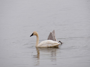 Wildlife along the Dalton is varied – cackling geese, tundra swans, musk ox, brown (grizzly) bears, caribou, snowshoe hares and fox are common, along with other kinds of birds as we transited various ecosystems. It was hunting season so the musk ox and caribou were hiding, but we did see some owls, peregrine falcons, and harriers. We were surprised twice, seeing moose in tundra areas where they’re not normally found.
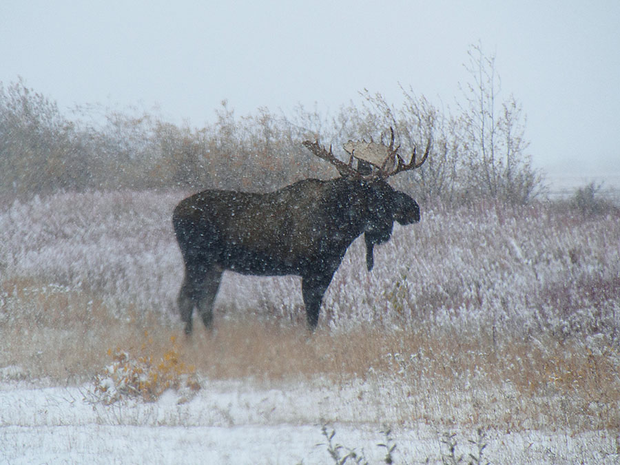
The scenery along the Dalton was so varied as we moved southwards – flat tundra, with a beautiful ridge of low mountains called the Franklin bluffs, along with pingoes – uplifted humps on the land.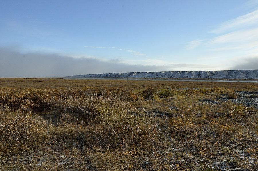
The northernmost mountain range in Alaska is the Brooks Range, and the Dalton (which shadows the Trans-Alaska Pipeline) crosses the Brooks Range at Atigun Pass – 4700 feet, and the only mountain pass that’s maintained all year round. On the 9th of September, we encountered a blizzard coming over the pass, though the snow stopped when we got to the south side.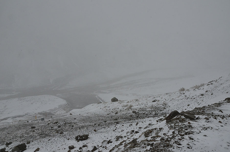
The pipeline follows the path of the Dalton Highway, visible about half of the time, when it’s above ground. 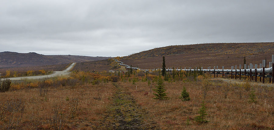
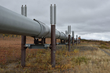 The road and pipeline crosses permafrost, and it’s important that the permafrost stays frozen, lest the structures built on it become unstable. Different kinds of heat sinks are employed to protect the permafrost, as you can see by the fins on top of the pipeline supports here.
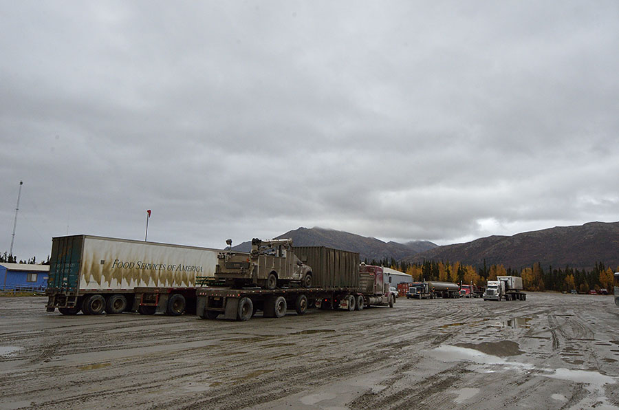
There aren’t many places to stop along the Dalton, despite the 150-250 trucks per day that travel on the road. The primary overnight stopping point is at Coldfoot Camp, one of the few places north of the Arctic Circle that is accessible by road. Coldfoot got its name from the gold rush period, where hopeful prospectors often lost their resolve and got “cold feet”. Like Deadhorse, it’s a pretty spartan place, with an old, scruffy modular building that serves as a hotel, and a separate building that serves plentiful hot food.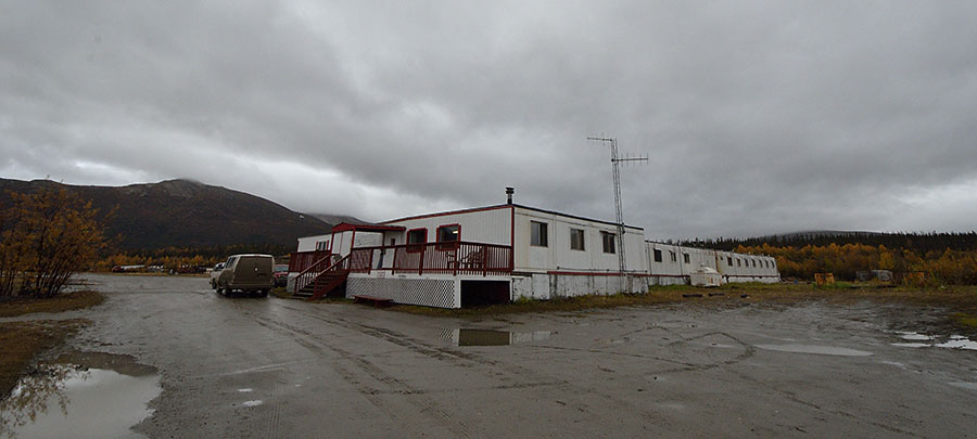
 You can see the mud – every vehicle is quickly enveloped in mud driving on the Dalton, and our tour guide stopped several times a day to wash the windows on the van so we could see.
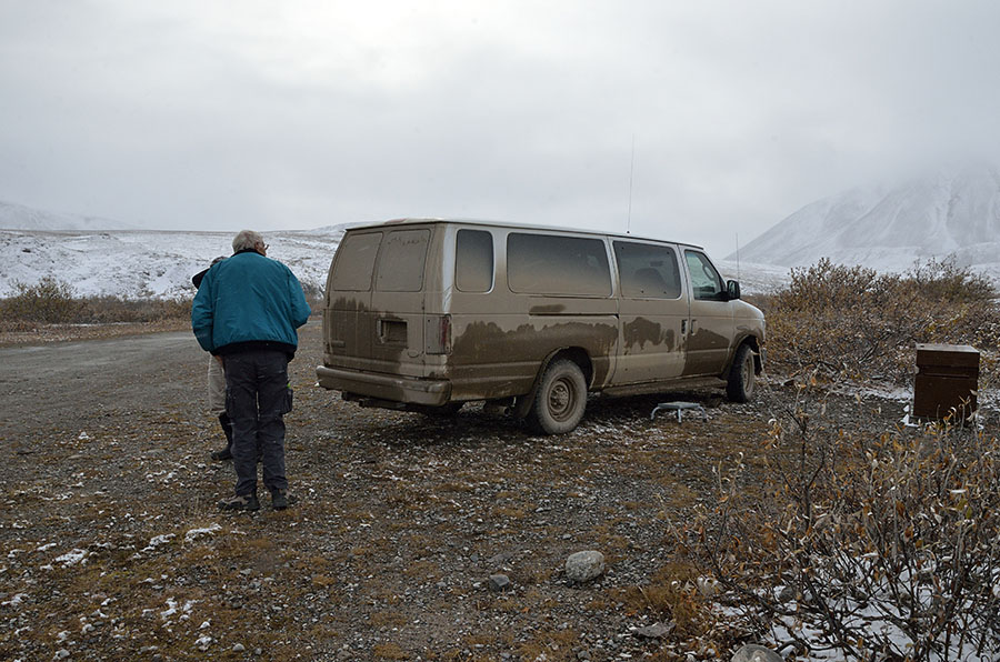 250 miles south of Deadhorse we crossed the Arctic Circle, pausing at a little roadside signpost to commemorate the event (even though we flew across it to get up to Deadhorse).
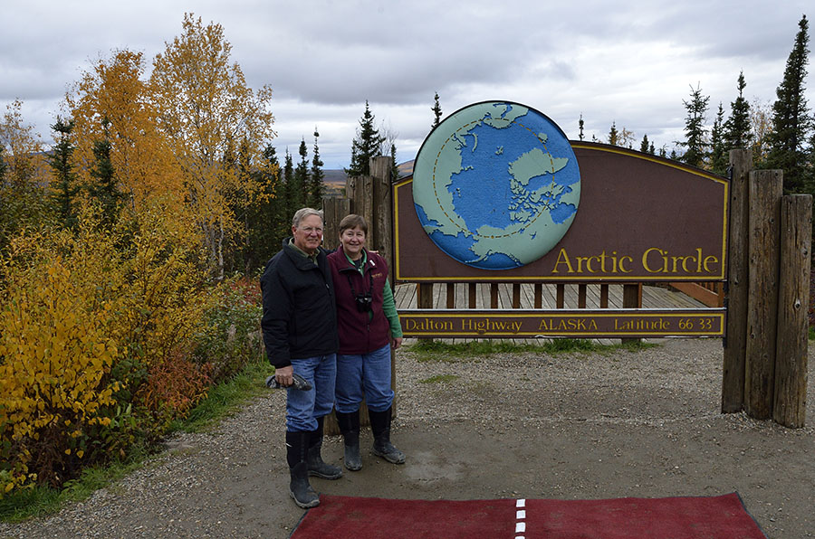 Our guide read a passage from Robert Service, and a little gray jay looked on. It’s hard to describe the adventure of a trip down the Dalton Highway, but it was a magnificent journey – so much to see and learn about, and we were glad to have an expert guide to explain so much. We crossed tundra, and taiga – Russian for “little forest” that describes the stunted black spruce that transitions from the Brooks Range to the boreal forest farther south. It felt odd to return to civilization in Fairbanks after the desolation and industrial feel of Prudhoe Bay, the wide open tundra, the pipeline, forests, blizzards, mud and sunshine along the way.
The Ford van? What were the rear tires, duel or some wider rim. I have a E-150 and would be in interested in something like that. When we head out for a long haul it is really heavy in the rear.
Joe Gillam
Hinesville, GA
j.gillam501@comcast.net